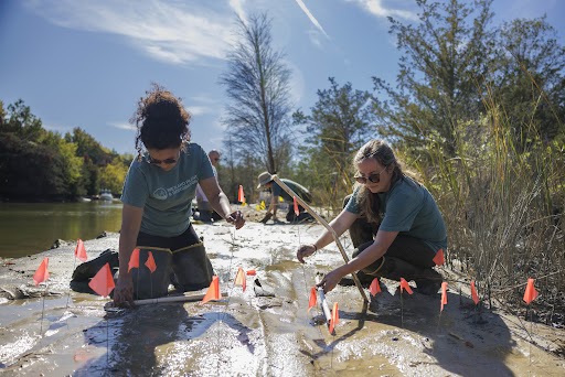
2013 Community Climate Adaptation Initiative
This $500K climate adaptation initiative is designed to support action to prepare for the current and predicted impacts of climate variability and change on America’s coastal communities. Applications to this competition must propose projects that identify and address the vulnerabilities a coastal community may face in adapting to climate change. These projects are expected to produce demonstrable outcomes by the end of the project period. Projects must be carried out in active partnership with local (county or municipal) leadership, and should include cooperation with relevant state, NOAA, and other Federal agencies, or other organizations, as appropriate.
The winning projects represent a diverse array of regions and challenges, and highlight to power of communities working together to address far-reaching challenges, partnering with universities and government to ensure the best science available is used to inform public decisions.
Santa Barbara Area Coastal Ecosystem Vulnerability Assessment for Coastal Communities
University of California Sea Grant
The Santa Barbara Area Coastal Ecosystem Vulnerability Assessment for Local Communities (SBA CEVALC) will create a vulnerability assessment of coastal ecosystems (beaches, wetlands and watersheds) for southern Santa Barbara County to assist the Cities of Santa Barbara, Carpinteria, and Goleta and the County of Santa Barbara in planning for adaptation to climate change. The SBA CEVALC will be developed from the work of three of the state’s leading ecological and climatological research programs and will be developed in close collaboration with the three cities and County. Community input will be integral to the project and coordinated, along with all other aspects of the project by California Sea Grant (CASG). Staff from all relevant city/county departments will participate in the project through workshops and reviews. CASG will guide development of the SBA CEVALC, work with community partners to distribute results locally and ensure wide distribution outside the Santa Barbara area.
While some coastal states and cities or counties are developing climate change vulnerability assessments, most focus on impacts to physical and built environments; they do not provide a comprehensive assessment of impacts to ecological resources. Incorporating ecosystems in local climate vulnerability planning is important since the majority of land-use planning decisions are made at the local level. Local governments regulate general land use and development activity for the majority of the land in California, where over half the land is owned privately. Local planning that does not consider ecosystems can result in fragmentation and degradation of ecosystem services. The SBA CEVALC is an important step toward ecosystem-based adaptation planning at the local level.
This work will bring together the best available climate and ecological research resources to provide a sophisticated coastal ecosystem vulnerability assessment, aimed at informing local land use decisions. The team has an unusual breadth of expertise that spans from upland watersheds to the shore zones. Beaches constitute the majority of the coastline in the Santa Barbara area and, along with wetlands and watersheds, are a critical component to the vulnerability assessment. Key historical climate patterns and possible climatic changes and other impacts to the Santa Barbara area will be evaluated Downscaled climate data, to monthly and daily time scales, will be employed. As well as multi-decadal variability, extreme events are a particularly important driver of physical and biological elements in these ecosystems—the project will include hydrologic models to simulate effects of drought and floods, as well as fire and coastal physical impact models.
Collaborative Climate Adaptation Planning for Urban Coastal Flooding
New Jersey Sea Grant Consortium
Hurricane Sandy was a painful reminder that coastal storms are among the world’s most costly and deadly disasters, capable of causing tens-to-hundreds of billions of dollars in damages and destroying entire neighborhoods. Increased damage from storm surge flooding is one of the most certain impacts of climate change, with the potential for intensified storms coming on top of rising sea levels.
Coastal cities across the country are weighing their options for adapting to rising floods, yet there is limited quantitative information available to help make these decisions. New Jersey Sea Grant’s project includes a collaboration between coastal flooding scientists and Jersey City planners to develop and test several options for adapting the region’s urban coasts to flooding and sea level rise. Jersey City is the second-most populous city in New Jersey, yet has 43% of its land within the new Federal Emergency Management Agency (FEMA) 100-year flood zones. The project will lay out a plan to leverage existing storm surge modeling to quantify the performance of a set of protective measures for Jersey City, including a variety of grey and green options such as storm surge barriers, deployable barriers, and wetlands.
The results of this project will include flood zone maps that account for future sea level rise and storm climatology changes including map animations of how floodwaters enter Jersey City to help understand how the pathways can be blocked; a set of coastal adaptation options, and assessment of their performance with future climate change; (4) an outreach workshop for regional stakeholders and an adaptation planning and evaluation framework. Lastly, Jersey City, and possibly additional area cities, will implement climate change planning policies to adapt to coastal flooding. The framework can also be utilized for many other U.S. coastal regions – anywhere that hydrodynamic models are already being used to simulate storm surges or map flood zones.
Reducing Flooding Vulnerability of Chicago Critical Facilities
Illinois-Indiana Sea Grant
Illinois-Indiana Sea Grant (IISG) will assist communities in the southern Lake Michigan region to become more resilient in the face of a changing climate. This project will help the City of Chicago make adaptive management decisions to reduce the vulnerability of critical facilities in the city to extreme precipitation, increasing the overall resilience of the most populous city (over 2.7 million) in the Great Lakes to climate change. Chicago will identify 25-50 critical facilities that are most vulnerable to flooding during extreme precipitation events. The project team will develop a site vulnerability assessment tool and facility checklist, and work with facility managers to develop recommendations and emergency management steps to reduce facility vulnerability and impacts from flooding by making short- and long-term infrastructure changes. Using this information, City of Chicago staff and IISG will develop climate resilience recommendations to reduce the vulnerability the critical facilities in Chicago. The team will also provide data and knowledge that facility managers can use to enhance emergency response plans in those facilities most at risk from flooding.
Without identifying the vulnerable infrastructure and facilities within a community and characterizing the weather events that threaten these critical areas, it is very difficult to develop effective adaptation plans for heavy rainfall events, which are likely to continue to increase in the future. By taking the necessary steps to develop climate resilience recommendations and emergency response tools in Chicago to protect critical infrastructure, Chicago will reduce its vulnerability to extreme precipitation, reduce loss to life and property, and increase its overall resilience to climate change. This project is a unique example of a major city (3rd largest in the United States) working closely with NOAA and university scientists to apply the best climate data and weather forecasts to city emergency management, operational management, and facility upgrade decisions.
Implementing Comprehensive Community Planning in St. Marys, GA and Hyde County, NC
Georgia Sea Grant and North Carolina Sea Grant
The southeastern (SE) Atlantic coast is highly vulnerable to climate stressors such as hurricanes, extreme rainfall, extreme drought, and sea level rise. This region has also experienced exceptional growth in both population and the built environment over the past several decades, and is expected to continue growing well above the pace of other U.S. regions for the foreseeable future. Without appropriate planning that takes climate stressors and geophysical hazards into account, an unfortunate consequence of these growth trends is that increasing numbers of people, property, infrastructure, and natural systems along the SE Atlantic coast are likely to become vulnerable to severe climate-related risks.
Given the seriousness of this regional problem, the Georgia and North Carolina Sea Grant programs will leverage key capacity strengths in service of developing community resilience and adaptation plans for two partner communities: St. Marys, GA and Hyde County, NC. These communities have sought out Sea Grant support due to existing climate stressors, particularly coastal flooding, that are expected to become exacerbated significantly by future sea level rise and increased occurrences of extreme rainfall events. The innovative integration of VCAPS (Vulnerability Consequences Adaptation Planning Scenarios) facilitation, benefit/cost modeling, and explicit linkage of adaptation action to CRS (Community Rating System) criteria action is expected to serve as an influential and replicable template for developing effective climate adaptation planning in coastal communities throughout the country.