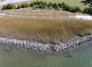
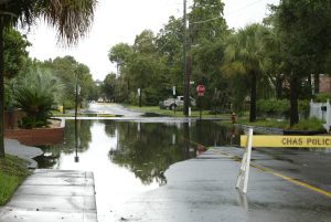
Even in a small state like Delaware agencies with planning, response, and data needs often lack the time and support to collaborate effectively and leverage investments, resources, and expertise. Coastal flooding is a frequent occurrence in Delaware, and local, county, state and federal agencies with a variety of missions need to be concerned with these events. In the past there has been no central coordination or cross-agency data synthesis for flooding data—particularly for high water marks. Measurements of high water marks can provide restoration and response data and improve the accuracy of predictive models.
As a direct consequence of Sea Grant support a new partnership has installed 15 water level sensors to monitor the coastal flooding throughout the town of Slaughter Beach. Data will help DNREC develop a coastal flood vulnerability assessment and long-term mitigation plan for the Town of Slaughter Beach and will serve as a model for other coastal communities along the Delaware Bay. Stronger collaborations with USGS have improved the sensor packages and will allow researchers to rapidly deploy temporary sensors prior to storm events. Work with the Delaware Department of Transportation is improving flood monitoring of transportation systems.