Climate and Hazard Adaptation
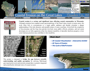
Visualizing Bluff Erosion
This project integrates animation, aerial photography, pictures, charts, and text to help the public better understand: (1) the natural process of coastal erosion; (2) how local land development decisions impact coastal erosion; and (3) the case for scientifically-based coastal development setbacks