Great Lakes
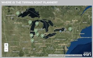
Tipping Points and Indicators
Tipping Points and Indicators, a research and extension program for Great Lakes coastal communities, helps local decision makers identify impacts of land-based activities that threaten the sustainability of ecosystems in their watershed. This program includes a web-based decision support syst​em (tippingpointplanner.org) and facilitated forum to explore policy and management interventions necessary to keep coastal ecosystems from reaching critical tipping points and moving to unstable conditions.