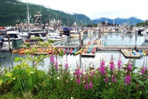
Aquaculture
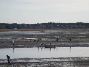
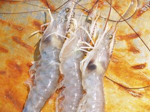
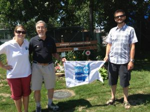
Quantifying Nitrogen in Shellfish Helps Planning Efforts on Cape Cod
Woods Hole Sea Grant is evaluating how the growing and harvesting of shellfish can reduce nitrogen loading and improve water quality in Cape Cod coastal bays.

Scroll down to view posts
Woods Hole Sea Grant is evaluating how the growing and harvesting of shellfish can reduce nitrogen loading and improve water quality in Cape Cod coastal bays.
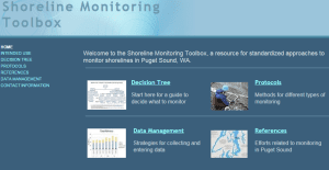
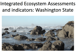
Washington Sea Grant, working with the Puget Sound Partnership and Puget Sound Ecosystem Monitoring Program Nearshore Work Group, has standardized approaches for monitoring and a “toolbox” of protocols and information. The toolbox emphasizes methods that are simple and affordable, and that can be used for monitoring restoration sites and evaluating status and trends.
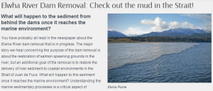
Dam removal on the Elwha delta has led to a massive flux of sediment to the coastal zone, leading to what is in effect the largest beach nourishment experiment ever in Washington State. Washington Sea Grant, in collaboration with the US Geological Survey, the Lower Elwha Klallam Tribe and others, is investigating the fate of that sediment and particularly how it acts to re-nourish eroding beaches. The results can be applied to problems associated with beach erosion due to climate change and sea level rise.

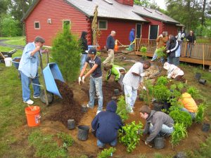
Classes, workshops, tours, displays, and web materials are provided to educate community members about practices they can employ on residential properties to reduce storm water impacts to receiving waters. The practices and information provided incorporate climate change adaptation benefits.
This report is a regional social science collaboration highlighting the gaps in knowledge related to people and marine environments. Robust social science is a fundamental aspect of ecosystem-based management; and moreover, provides necessary information for understanding resilience and vulnerability to human populations.
The emerging human wellbeing model is a comprehensive look at the material, relational, and subjective ways that the socioeconomic wellbeing of individuals and communities is tied to marine and coastal resources. The model provides a process for selecting indicators to measure human wellbeing.
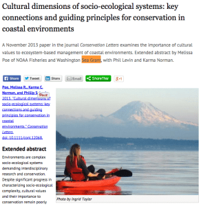
The cultural dimensions of coastal ecosystems framework and guidelines for best practices is a conceptual tool to guide scientists, managers and community practitioners in their efforts to: (1) identify potential cultural impacts in impacted areas; (2) select and develop methods for working with communities to characterize their cultural impacts. Cultural aspects are often ambiguous and moreover absent from vulnerability and resilience assessments and this guidelines offers clear and specific identification of cultural aspects that have been or could be impacted in events.
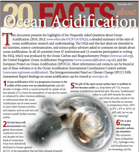
Washington Sea Grant, in partnership with state, federal (NOAA) and international scientists and communication experts have released two ocean acidification fact sheets as aids for scientists, science communicators and science policy advisors asked to comment on acidification: “20 Facts About Ocean Acidification” (Nov 2013. revised Feb 2014) and “Ocean Acidification in the Pacific Northwest” (May 2014). They have also been instrumental in the development of NOAA's Sharing Ocean Acidification Resources for Communicators and Educators (SOARCE) webinar series (8 presentations in 2014).
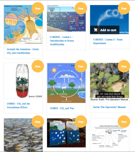
Washington Sea Grant, in partnership with the Suquamish Tribe, and with assistance from teachers, and state and academic education specialists, is developing a curated online collection of Ocean Acidification curricula, teaching tools, and informational resources for high school, middle school and elementary classrooms. The online collection, which will launched in Oct 2014, can be searched using a variety of filters, such as grade band, subject, type of material (i.e. lab activity, presentation, reading and analysis, etc.), and length of activity. This effort supports coastal resilience by building ocean acidification literacy.

In Puget Sound, shoreline armoring is being removed or is being replaced with what are thought to be less disruptive alternatives. Restoring physical and biological connections in the nearshore where structures are not at risk is expected to improve habitat conditions and reduce long-term costs for homeowners. By establishing volunteer monitoring of these sites, Washington Sea Grant has helped create a baseline for erosion and vegetation that can be used to inform other projects and shoreline management decisions in the near-term and provide a long-term reference as climate change and sea level rise influence conditions in the nearshore.
Preventing the introduction and spread of aquatic invasive species is the only way to eliminate associated ecological and economic damages. Where prevention measures fail, early detection of a newly established population offers the best hope of effectively reducing impacts. By working formal and informal education settings to encourage prevention measures and by establishing a network to monitor marine waters for key species of concern, Washington Sea Grant aims to prevent and reduce economic and ecological harm for coastal communities.

These workshops are designed to bring confidence to homeowners and businesses so that they can properly manage their on-site sewage systems. The workshops focus on the monitoring and maintenance of septic systems during all conditions and highlight special monitoring after an earthquake, during flooding events and power outages.
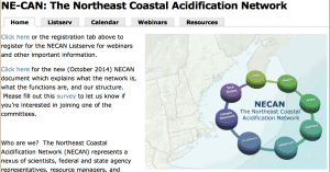
Maine Sea Grant is a member of the steering committee for the Northeast Coastal Acidification Network planning a series of 10 Ocean Acidification Webinars, a synthesis of the State of the Science, culminating in a State of the Science workshop followed by Stakeholders workshops to develop an Ocean Acidification plan for the region (Long Island Sound to Nova Scotia).
Sea Level Affecting Marshes Model maps (SLAMM), will be available on the web in October for all 21 coastal communities. This is being adopted for “planning purposes” by the State Coastal Resources Management Council.
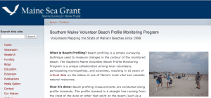
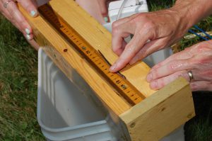
Beach profiling is a simple surveying technique used to measure changes in the contour of the monitored beach. The Southern Maine Volunteer Beach Profile Monitoring Program is a unique collaboration among local volunteers, participating municipalities, and scientists, resulting in 15 years of critical data on the status of one of Maine's most vital and valuable natural resources.
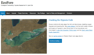
The project created, tested and applied models to forecast how anthropogenic (land use, invasive species) and natural (climatic variability) stresses influence hypoxia formation and ecology, with an emphasis on fish production.
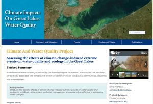
The Climate and Water Quality diagram is used for public outreach to show interaction of climate, water quality, land use and invasive species.
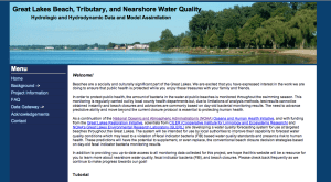
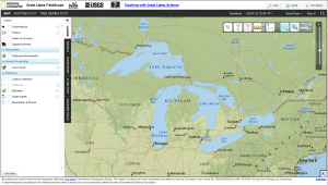
The Great Lakes Beach, Tributary, and Nearshore Water Quality: Hydrologic and Hydrodynamic Data and Model Assimilation website hosts a water quality forecasting system for use at targeted beaches throughout the Great Lakes.
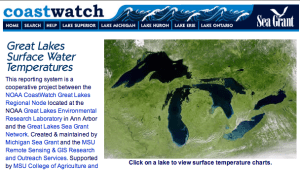
Michigan Sea Grant has created a customized user interface for the NOAA CoastWatch data reporting system, evolving as a cooperative project between the NOAA CoastWatch Great Lakes Regional Node (NOAA GLERL) and the Great Lakes Sea Grant Network.
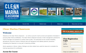
With funding from the Great Lakes Integrated Sciences and Assessments center, Michigan Sea Grant led a team in developing a new unit for the Clean Marina Classroom (an online training tool for marina, harbor and boatyard operators in pursuing Clean Marina certification).
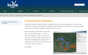
Michigan Sea Grant website to host Great Lakes Environmental Response Management Application (ERMA) tool, an online mapping tool for coastal pollution cleanup, restoration, and response efforts in the Great Lakes Basin, from Minnesota to New York in the United States and from Ontario to Quebec in Canada.
This congressional act provides matching funds to communities to speed up the pace of cleanup of contaminated sediments within Great Lakes Areas of Concern. Illinois-Indiana Sea Grant conducts workshops, provides local community support, and has developed numerous products including curricula, economic development strategies, and fact sheets.
North Carolina Sea Grant funded research to determine impacts of rerouting water into the Alligator River National Wildlife Refuge as part of a proposed wetland restoration project.
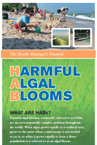
This beach manager’s manual provides the latest information and management strategies for harmful algal blooms, type E botulism outbreaks, and other topics in the future.
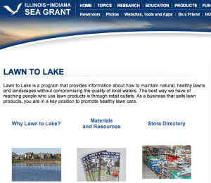
Lawn and garden chemicals applied in the Lake Michigan basin can wind up in the water, polluting the lakes with pesticides and excess fertilizer. The program promotes healthy landscape practices, offering communities, landscapers, residents, and others, tips for maintaining healthy lawns and landscapes without over-relying on chemicals.
Since 2001, Illinois-Indiana Sea Grant has hosted workshops pertaining to various aspects of river and stream restoration, including dam removal. The River Restoration: Practices and Concepts workshops provide the opportunity to hear about the latest restoration projects from experts nationally as well as from the region, and communicate with other professionals with similar interests.
Plastics are found in many common household items, and despite our best efforts to recycle, a good fraction—no one knows how large—becomes litter which can have devastating impacts on coastal ecosystems and the animals that live there. In a new study, South Carolina Sea Grant Consortium scientists are researching the presence and effects of microplastics in coastal environments.
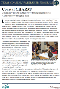
The Community Health and Resources Management (CHARM) mapping application is a robust citizen planning tool, built on CommunityViz and ARCMAP, that enables citizens and professionals alike to explore large and small development scenarios that reveal impacts, instantaneously, to the environment by the development, as well as impacts to the development (e.g., storm surge).
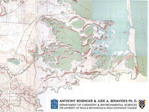
By geo-referencing and overlaying historic aerial photography on current digital photographs, Texas Sea Grant along with multiple other partners have identified habitat restoration priority areas along the Texas coast.
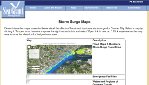
The Chester Climate Adaptation Team produced this series of 11 interactive Google Maps to assess the risk to the City's population, infrastructure, and environment from varying levels of flooding.
Over the past 200 years, Rhode Island has lost over 50 percent of its salt marshes due to coastal development, resulting in a loss of approximately 4,000 acres statewide. Rhode Island Sea Grant and partners are working to develop the Sea Level Affecting Marshes Model (SLAMM). The model will be used to help identify the most vulnerable areas to target for protection and restoration.
This is an outreach tool designed to guide communities through a range of strategies from landscape to plot level for water quality protection.
This tool was used to illustrate how social science findings could be used in a watershed wide non-point source pollution reduction campaign.
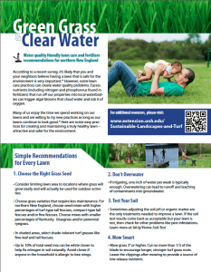
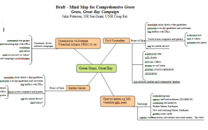
These tools are the result of a multi-state, integrated Sea Grant /Cooperative Extension coordinated project that supported both turf and social science research to reduce nitrogen losses from turf care and maintenance by do-it-yourself'ers.
Pennsylvania Sea Grant helped students at Mercyhusrt University complete a year long social change campaign to educate their college community about the issues involved in pharmaceutical and personal care product use and disposal.
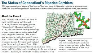
Connecticut Sea Grant and CLEAR partnered to conduct a GIS analysis of riparian buffers for Connecticut and to develop an outreach program on riparian areas.
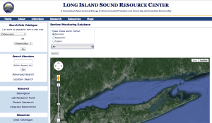
The Sentinel Monitoring for Climate Change Program in Long Island Sound is a multi-disciplinary scientific approach to provide early warning of climate change impacts to Long Island Sound ecosystems and species to facilitate appropriate and timely management decisions and adaptation responses.

Connecticut Sea Grant and CLEAR developed a web-based tool which leads resource managers through the process of developing a long-term habitat based management plan with information provided on coastal habitat types, management and restoration so as to maximize the long term resilience of natural areas.

CLEAR and CTSG partnered to develop a Rain Garden App designed to help people properly install a rain garden, a critical tool in the face of changing precipitation patterns.
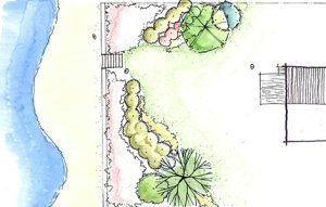
With EPA support, Connecticut Sea Grant partnered with CLEAR and University of Connecticut's Deptartment of Plant Science and Landscape Architecture to produce the web-based tool, Coastal Riparian Landscaping Guide for Long Island Sound.
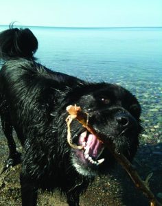
Harmful algal blooms or HABs are increasing in many areas and while people may be getting sick, dogs are actually dying. New York Sea Grant has put together informative brochures and fact sheets to help people understand how to keep their beloved pets safe.
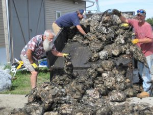
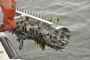
Promoting Oyster Restoration Through Schools or Project: PORTS has seeded more than 20 million oysters in conservation sites like Gandy’s Beach throughout the Delaware Bay since it began in 2007. It is led by New Jersey Sea Grant Consortium and partner Lisa Calvo at the Shellfish Aquaculture Coordinator for Rutgers University.
North Carolina Sea Grant develops varied techniques and technologies that address water quality issues. Research teams study the ability of restored wetlands to control runoff, test new sensor technology to monitor water quality in tidal marshes, and verify that fish ear bones, known as otoliths, can identify early-life habitats of fish.
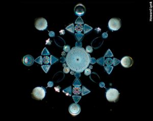
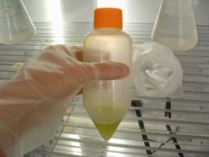
With funding from Sea Grant and other agencies, Euan Reavie, Senior Research Associate with the University of Minnesota Duluth’s Natural Resource Research Institute, and his colleagues have been examining sediment cores to reveal the extent to which they have captured the story of Great Lakes water quality over the past several centuries.
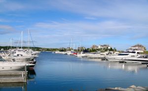
The Green Marina Education and Outreach Project has resulted in 69 Clean Marina certifications, approximately 5,000 best management practices implemented, and more than 2,200 individuals participating in Clean Marina workshops. Michigan Sea Grant coordinated the project in partnership with Wisconsin and Ohio Sea Grant programs.
Lake Champlain Sea Grant is funding research to determine the best treatment to reduce stormwater runoff pollution by comparing water quality across different soil media, vegetation, and hydrologic regimes.
As shrimpers battle against a reemerging parasite, Georgia Sea Grant is providing research and outreach to battle this threat to Georgia’s largest commercial fishery.
Looking to improve water quality both locally in the river and as part of a regional effort to restore the Chesapeake Bay watershed, the town of Laurel, Delaware is reimagining its historic riverfront with help from the Delaware Sea Grant College Program and University of Delaware landscape design faculty and students.
Mike Whitney, PhD and Penny Vlahos, PhD, Associate Professors of Marine Sciences at the University of Connecticut, are a physical and chemical oceanographer team that are funded by Connecticut Sea Grant to research the source perfluorinated compounds or PFCs in Long Island Sound.
It might seem incongruous to talk of traffic disputes and costly collisions in an area as vast as the waters off the Pacific coast. But that’s the situation that afflicted the coast’s tribal and commercial crab fishers and its tug-and-barge and shipping operators for decades as they shared the same sealanes.
Sarah Orlando is an Extension Educator based in the Ohio Department of Natural Resources’ Office of Coastal Management in Sandusky. She is the coordinator for the Ohio Clean Marinas and Clean Boaters programs, voluntary, incentive-based programs to help maintain and improve coastal and Lake Erie
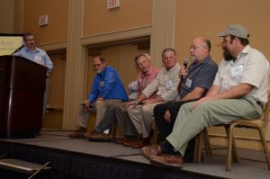
Virginia Sea Grant and partners organized a day long workshop bringing together fisherman and scientists to discuss collaborative fisheries research to improve gear and fishing methods. The 2014 workshop focused on shrimp fisheries and turtle bycatch.
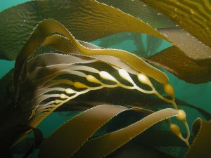
USC Sea Grant is helping to fund Kelp Watch 2014, a research initiative that uses fast growing kelp forest species as living dosimeters of the Fukushima released radioisotopes. Co-founder Dr. Manley hopes Kelp Watch 2014 will provide the public with immediate data as to whether there are any direct human health risks to the small amounts of radioactivity in the ocean.
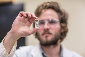
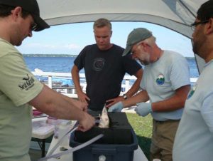
PhD student Sean Brennan at University of Alaska Fairbanks with funding from Alaska Sea Grant used strontium isotopes to identify the birthplace of adult salmon harvested in mixed-stock commercial fisheries.
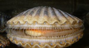
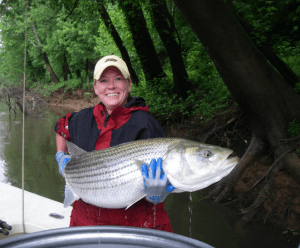
Average world ocean pH has dropped from 8.2 to 8.1 over recent decades and is expected to drop to 7.8 by the end of the century. Dr. Meredith White, with funding in part, from Woods Hole Sea Grant, examines how this shift may effect the commercially valuable bay scallop, Argopecten irradians
Even catch and release bass fishing tournaments can have a negative effect on fish populations. Research by Aquatic Resources Specialist Mark Malchoff of Lake Champlain Sea Grant and partners is helping to reduce those negative effects.
A team of University of Wisconsin-Madison researchers have discovered key factors in predicting how and at what levels metals such as copper and cadmium harm Great Lakes shoreline environments and what protective measures coastal organisms adopt in response.
South Carolina Sea Grant funds research to explore the best management practice of stormwater ponds to capture runoff and whether there are ways to make these ponds more effective, efficient and less costly to manage.
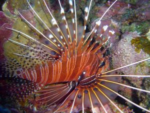
Sea Grant Puerto Rico combats lionfish invasion by promoting its capture, sale, and consumption.
As part of the Rhode Island Shellfish Management Plan Rhode Island Sea Grant is funding research to assess how traditional means of estimating clam population affect fishing limits.

Dredging shipping channels is an unavoidable part of harbor maintenance across the Great Lakes. But once the sediment is removed from the shipping channel, where does it go? Funded by Ohio Sea Grant Dr. Elizabeth Dayton, Research Scientist in Ohio State University’s School of Environment & Natural Resources, is working to reuse of up to 100,000 cubic yards of dredge material per year.
Dredging shipping channels is an unavoidable part of harbor maintenance across the Great Lakes. But once the sediment is removed from the shipping channel, where does it go? Funded by Ohio Sea Grant Dr. Elizabeth Dayton, Research Scientist in Ohio State University’s School of Environment & Natural Resources, is working to reuse of up to 100,000 cubic yards of dredge material per year.

North Carolina Sea Grant has brought together scientists and commercial fishermen to understand the black sea bass population in the South Atlantic. The studies have led to increased catch limits and gear that keeps legal-sized fish while letting out undersized sea bass.
Steve Jones Associated Director of New Hampshire Sea Grant founded the Coastal Research Volunteers with the goal to provide volunteers with opportunities to engage in meaningful science and to benefit scientific research in the region. The program has been going strong for three years and is an overwhelming success, with volunteers helping researchers collect data they would otherwise be unable to collect.
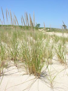
Dunes are dynamic entities, they accrete and deplete, get damaged in coastal storms, and suffer through abuse by humans. In an attempt to mitigate the damage, New Jersey coastal communities often plan Ammophilia seedlings to deliberately construct dune systems to act like barriers against coastal damage during storms, effectually shoring up the coast. However, there’s a fatal flaw in this approach.
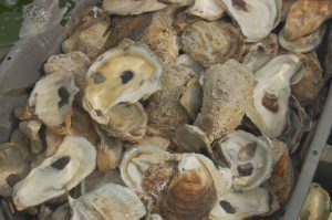
Researchers at the University of New Hampshire are studying two illness-causing species of bacteria found in oysters to obtain a more detailed understanding of microbial life on the half-shell. The ultimate goal is to minimize risks to human health without having to close shellfish beds for long periods of time.
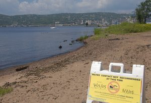
Backed by Minnesota Sea Grant’s commitment to research Dr. Michael Sadowsky and his colleagues have shown that Escherichia coli and enterococci, the bacteria responsible for "Water Contact Not Recommended" beach advisories, can often be traced back to waterfowl and other animals. Water sullied by waterfowl might be nasty, but it is not a serious human health concern.
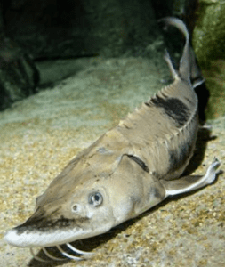
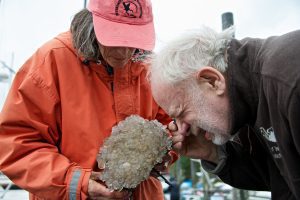
Fourteen Lake Sturgeon were transported to the Shedd Aquarium in Chicago, IL where they will increase public awareness about the fascinating history behind Sturgeon and the importance of the species to the Great Lakes ecosystem.
If you were to pour a bucket of water in your yard, where would the water end up? Great Lakes FieldScope is a new interactive mapping tool that will help explore what happens to that water. Students, teachers, and nature enthusiasts can share and analyze real-world data, including observations they took themselves!
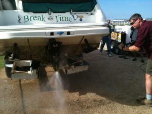
The National Sea Grant Law Center and partners recently embarked on an innovative project that is bringing together individuals from three professional communities that rarely interact – Assistant Attorneys General, law enforcement personnel, and aquatic invasive species coordinators to improve management of the primary vector for the spread of aquatic invasive species, the trailered boat.
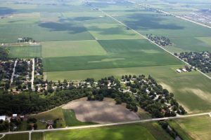
Maryland Sea Grant researchers identify and map previously unrecorded Maryland streams. The additional detail is expected to inform conservation and development projects statewide.
Smithsonian researchers partnered with Gary Freitag, an Alaska Sea Grant Marine Advisory Program agent, to hold a volunteer-led assessment of invasive species off the coast of Ketchikan, Alaska.
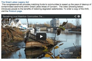
The Great Lakes, a vital asset to 35 million residents, have a legacy of pollution due to our nation's industrial past. The Great Lakes Legacy Act revitalizes rivers, lakes, and harbors, helping to restore lost benefits. This video outlines the Great Lakes Legacy Act and highlights benefits it brings to communities.
Illinois-Indiana Sea Grant is leading the effort to develop an online tool that allows community planners to make informed decisions regarding land use by identifying how watershed ecosystems will look in the future if current land use practices continue or are ramped up.
Guam Sea Grant and University of Guam researchers are tackling the threat of invasive algae in Micronesia using modern genetic techniques.
Horseshoe crabs, whose eggs are vital to migratory shorebird feeding stopovers, have strict harvest quotas due to over harvesting in the 1990s. A research team led by Nancy Targett, director of Delaware Sea Grant, has developed an artificial bait that has the potential to reduce the number of horseshoe crabs needed to catch eel and whelk.
George Loomis, a soil scientist and director of the New England Onsite Wastewater Training Center at the University of Rhode Island, is part of a research team supported by Sea Grant that is looking at the current designs and parameters for septic systems against various climate change scenarios.
With the support of The University of Southern California (USC) Sea Grant Program and the California Ocean Protection Council, Dr. Kelley has pioneered the use of a cutting-edge technology—proteomics—to see the “fingerprints” or impacts of endocrine-disrupting compounds in fish.
Scientists release new projections for future sea level rise for the Chesapeake Bay and for Maryland, Virginia and nearby Mid-Atlantic coastal areas. In these, regions sea levels are rising faster than the global average, the result of subsiding lands, a slowing Gulf Stream and melting land ice in Antarctica.
For more information on this study see Maryland Sea Grant
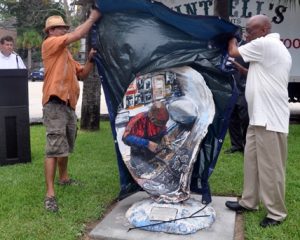
A colorful new art display opened up in downtown Mobile, AL to increase public awareness of the role oysters play in Mobile Bay.
The Great Lakes may span eight states and two provinces, but the threat of new aquatic invasive species is a constant reminder that the region is connected in more than name alone.
Imagine Boston, Charleston, San Francisco or Seattle without fresh seafood, pleasure boats or shipping vessels. It is an impossible task. The history, culture and identity of these communities are inextricably linked to their “working waterfronts,” which are places for active, water-related commerce and desirable areas in which to live and work. Unfortunately, many of these working waterfronts face a growing number of challenges.
Rain Garden, a new free iPhone app, guides users on how to create and install rain gardens that curtail runoff of pollutants, prevent erosion, and provide wildlife habitat. Development of the app was funded by the NOAA Sea Grant Climate Change Adaptation Capacity Building Initiative and developed by Connecticut Sea Grant and the University of Connecticut Center for Land Use Education and Research.
Marine and coastal environments form complex interdependent webs of life where organisms of all sizes interact according to intricate rules of survival….