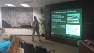
Climate
Online Video Explains Rapid Sea Level Rise
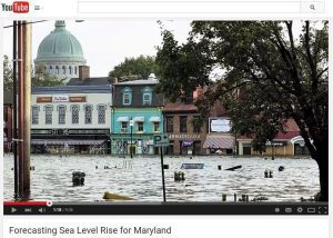
Maryland Sea Grant produced a nine-minute online video documentary that describes scientific research about the causes of rising seas in the Chesapeake Bay region.

Scroll down to view posts
Maryland Sea Grant produced a nine-minute online video documentary that describes scientific research about the causes of rising seas in the Chesapeake Bay region.
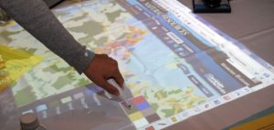
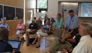
With support and training from Texas Sea Grant, Maryland Sea Grant Extension employs the weTable tool to facilitate decision-making processes in a range of communities.
New York Sea Grant’s Great Lakes Coastal Processes and Erosion homepage provides information focused on the educational needs of New York’s Great Lake’s shoreline property owners, resource users and decision makers, marine contractors, and recreational boaters.
This website contains information, data, and tools that individuals, communities, and governments at all levels can use to develop, inform, and enhance their sustainable working waterfront initiatives.
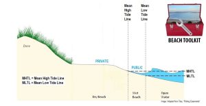
Part of the Florida Water Access site, the Beaches Toolkit contains an outline of common law tools for addressing public beach access, as well as resources for public and private managers of beachfront property.

Oregon Sea Grant's Coastal Natural Hazards Specialist stresses preparedness, not panic or indifference, in the wake of increased attention to the Cascadia Subduction Zone and the likelihood of an earthquake in Oregon.
A symposium at Hofstra University was held to share a NOAA Coastal Storm Awareness Program-funded project that explored the cultural and language barriers that may have hindered evacuation efforts in Long Beach, NY.

The city of Chelsea, Massachusetts' Planning Board has new climate change adaptation guidance thanks to a group of students from Worcester Polytechnic Institute and MIT Sea Grant.
NOAA’s Coastal Storms Program is collaborating with Sea Grant and others to improve safety for Great Lakes beach-goers.
" I get to work with some of the most passionate, smart, and genuine people I have ever met, helping them to manage and protect some of the most beautiful and unique places in the country. "
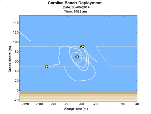
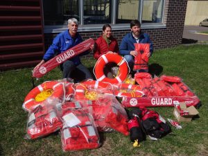
Rip currents account for 80 percent of beach rescues. North Carolina Sea Grant's data-logging drifters identify patterns in this beach hazard.
” Everyone needs to be informed about weather and consequently wave dynamics on the lake and in the nearshore zone.”
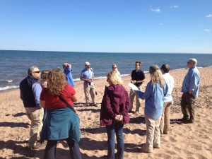
Federal, state, and local partners come together to discuss the forecasting and communication of rip currents and other coastal hazards on the eve of beach season.
New York Sea Grant is asking people along Lake Ontario and North Sandy Pond to share stories and photos of storm events to help local communities better assess risk, build storm resiliency, and reduce future storm damage and recovery expenses.
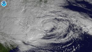
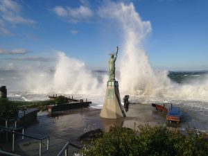
As Hurricane Season begins, Sea Grant continues to prepare coastal communities for hurricanes and coastal storms. Learning from past events, Sea Grant aims to strengthen the resilience of infrastructure and empower coastal residents.
Making yourself hurricane-proof is a deliberate act. Residents of storm-prone areas need a plan and to be able to execute it. The Homeowners Handbook helps individuals make their families and homes more resilient.
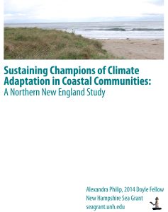
Leaders who are helping their coastal communities adapt to sea level rise, increases in heavy precipitation and flooding need additional technical, human and financial assistance to do so, according to a report by a 2014 New Hampshire Sea Grant Doyle Fellow.
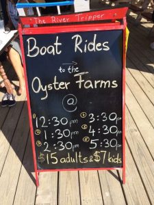
Tourists are increasingly interested in experiences that allow them to support and connect with the people and places that they visit. Maine Sea Grant is facilitating such experiences by assisting with the creation of oyster farm tours, combining the tourism and fisheries industries that already exist in Maine.
Once an important waterway to reach the French Quarter, then forgotten, Bayou St. John has been restored and become a destination for many New Orleanians.
Community leaders, decision-makers, and staff need detailed knowledge of the resources their community possesses in order to make informed planning decisions that enhance the community while protecting the quality of the environment. Developed in partnership with Clemson University’s Baruch Institute of Coastal Ecology and Forest Science, the S.C. NEMO Program, Carolina Clear, and the North Inlet-Winyah Bay National Estuarine Research Reserve, the Community Resource Inventory provides an atlas of natural and cultural resources available in South Carolina coastal communities.
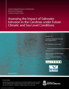
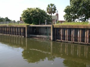
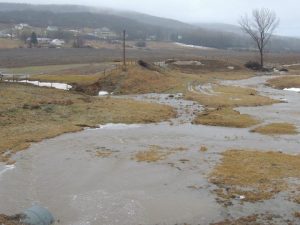
Reduced river flows during drought threaten fresh water supplies in coastal areas because the lower flows allow the salt water wedge to penetrate further inland from estuaries than is normal. During droughts over the past decade, some coastal drinking water systems and industries monitored threats to fresh drinking water and industrial water intakes due to this salinity intrusion; some have even had to periodically take intakes offline due to high salinities that can damage drinking water treatment systems and industrial equipment. To help decision-makers understand how the frequency of salt water intrusion events may change under future precipitation and sea level scenarios, the S.C. Sea Grant Consortium, the Carolinas Integrated Sciences and Assessments center at the University of South Carolina, and the USGS S.C. Water Science Center adapted an existing decision support system for salinity intrusion in the coastal Yadkin-Pee Dee river basin by adding climate model-based precipitation scenarios and increments of sea level rise to the Model 2 (PRISM2) decision support tool. This modification is significant in that it allows water managers to explore how often salt-water intrusion events may occur in the Yadkin-Pee Dee River basin under conditions influenced by ongoing and future climatic change.
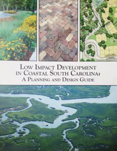
Many coastal decision-makers lack the expertise, guidance, and resources to implement low impact development (LID) techniques for mitigating stormwater impacts. The S.C. Sea Grant Consortium assisted with the development of an LID manual specific to coastal South Carolina that provides guidance on overcoming barriers to implementing best management practices. The project team organized stakeholder workshops, research roundtables, and provided technical assistance with the development of the guide.
The Southeast and Caribbean Climate Community of Practice (CoP) brings together individuals from local, state, and federal governments, academia, non-profit organizations and the private sector in North Carolina, South Carolina, Georgia, Florida, and the Caribbean to apply climate science and assess how coastal communities and ecosystems can adapt to the impacts of climate variability and change. The CoP provides a forum for sharing lessons learned and best practices related to climate communication and adaptation. The CoP also provides education and networking opportunities to its members and their stakeholders to increase knowledge and awareness of climate science and to coordinate and perform outreach, extension, and communication related to climate change and its impacts in the Southeast and Caribbean region.
South Carolina Sea Grant The S.C. Sea Grant Consortium, in partnership with the Social and Environmental Research Institute, is working with blue crab fishermen in
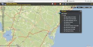
The S.C. Sea Grant Consortium, in partnership with the Beaufort County Planning Department, Carolinas Integrated Sciences and Assessments program, Social and Environmental Research Institute, and North Carolina Sea Grant, provided a participatory opportunity for Beaufort County to begin preparing for flooding associated with sea level rise. The project team utilized several available tools to engage local stakeholders in the process. A focus group participated in the Vulnerability and Consequences Adaptation Planning Scenarios process to identify local consequences of sea level rise and explore potential adaptation strategies. Sea level rise visualizations developed with data from NOAA’s Digital Coast Sea Level Rise Viewer tool helped stakeholders understand the risks of future coastal flooding due to rising seas. Public workshops were held to get broader input on adaptation strategies. A final report has been compiled for consideration by Beaufort County Council. This project has initiated a process of community learning that will increase the capacity of Beaufort County to adapt to sea level rise.
With the vast majority of land-use decisions made at the local level, community officials are instrumental in influencing and directing development and conservation efforts. The S.C. Coastal Communities Initiative is a collaborative land-use planning and water quality small grants program for local decision-makers. The purpose of the Initiative is to assist coastal communities with the development and implementation of land management policies and practices to reduce polluted stormwater runoff, protect local natural resources, and encourage sustainable development. Coastal communities participating in the Initiative are eligible to receive grants ranging from $2500 to $5000 to address a variety of issues related to open space preservation, natural resource-based planning, water quality management, alternative transportation, sustainable community planning and design, and zoning ordinances and regulations.
Lake Champlain Sea Grant is partnering with organizations across Vermont to help towns plan and prepare for climate change and flood resiliency.
By incorporating social science into the equation, Great Lakes Sea Grant programs are helping to meet societal needs.
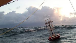
Washington Sea Grant’s hazard specialists expose the dangers on a coast where even the Coast Guard is vulnerable.
A new Coastal Storm Awareness Program study finds that many residents of coastal Connecticut need to be better prepared for the significant safety and economic threats posed by severe coastal storms.
Tsunamis have been a reality for coastal communities for as long as humans have lived near the shore. NOAA Sea Grant has been working with coastal communities for many years to help residents understand tsunami risks, reduce their vulnerability and respond quickly.
New York Sea Grant received funding from NOAA's Coastal Storms Program through a Sea Grant competition to study historic storm events along the eastern shore of Lake Ontario. The project will create a climatological event database to better assist risk projection to help communities increase their storm event resiliency.
Master’s students at the University of Guam receive funding to work on thesis research in areas of sustainable coastal community development.
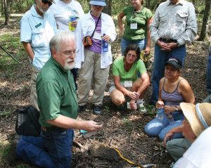
Dr. John Jacob takes a holistic approach to educating citizens and local officials, noting that the watershed is affected by a wide range of activities from landscaping and other things people do around their homes to large urban planning and habitat protection activities.

David Hart is Assistant Director for Extension with the University of Wisconsin Sea Grant Institute and a Senior Scientist with the UW Aquatic Sciences Center. His research and outreach spans geographic information science, urban planning, and coastal management.

Experts at New York Sea Grant discuss issues, and potential solutions between communication and the decision process as they relate to extreme weather events.
Is there room on the water for everybody? If coastal communities are to remain sustainable, residents, visitors, policy makers, and regulators need new methods and information sources to harmonize the growing demand for access to their beaches and waterways. Researchers and extension specialists at Florida Sea Grant are making that challenge a priority.
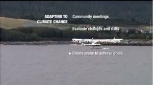
This video describes steps some communities are taking to maintain their lifestyles in the face of climate change.
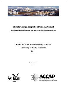
This manual is for Alaska extension professionals, community organizers, local planning officials, and teachers, whose task is to help individuals, families, businesses, communities, and local governments think through the meaning of climate change on the local scale.
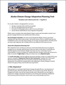
This adaptation tool will help Alaska community residents identify impacts from environmental changes, devise strategies for coping with the changes, and locate resources to help.
These climate change adaptation resources are useful to community residents and professionals who are planning strategies for adaptation.
Alaska Sea Grant’s climate adaptation website has links to Alaska-specific climate change fact sheets, videos, Powerpoint presentations, other publications, and websites of other organizations and resources.
Alaska Natives are witnessing climate changing the ecology around their communities. Three southwestern communities are partnering with Alaska Sea Grant researchers to share their traditional hunting knowledge in an effort to conserve their marine environment.
The Santa Barbara Area Coastal Ecosystem Vulnerability Assessment for Local Communities (SBA CEVALC) is aimed at assisting the Cities of Santa Barbara, Carpinteria, and Goleta and the County of Santa Barbara in planning for adaptation to climate change. Three of the state's leading ecological and climatological research programs including: the UCSB Coastal Long-Term Ecological Research Project, the Scripps Institution of Oceanography and USGS, are accomplishing the project in close collaboration with the three cities and County. Community input is integral to the project with staff from relevant city/county departments participating through workshops and review.
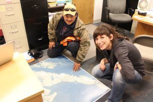
Alaska Sea Grant Marine Advisory agent Terry Johnson and others assisted the village of Shaktoolik with planning and implementing measures to “defend in place” against coastal storms.
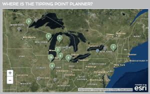
Tipping Points and Indicators, a research and extension program for Great Lakes coastal communities, helps local decision makers identify impacts of land-based activities that threaten the sustainability of ecosystems in their watershed. This program includes a web-based decision support syst​em (tippingpointplanner.org) and facilitated forum to explore policy and management interventions necessary to keep coastal ecosystems from reaching critical tipping points and moving to unstable conditions.
This National Sea Grant Resilience Toolkit allows people to learn about tools from across the entire Sea Grant network giving users the opportunity to adapt tools for their own local needs. Each entry includes a description of the tools, a link for more information, and a point of contact.
The purpose of this assessment tool is to provide community leaders, administrators, planners, engineers, public work directors, and natural resource managers with a simple method in the form of a checklist divided into nine different categories to review their community's particular vulnerabilities to climate trends and to identify priority areas to focus on through planning and projects. The goal of this tool is to help communities in the Great Lakes region identify and address vulnerabilities through education and planning to help reduce the impacts and costs of climate change-related damage through adaptation policies and procedures.
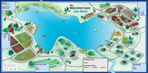
The Watershed Game is an interactive tool that helps community leaders understand the connections between land use, clean water and their community. Participants learn how a variety of land uses impact water and natural resources and learn how their choices can prevent adverse impacts.
Vertical land movement, caused by sediment settling, groundwater extraction, and tectonic forces, can boost or reduce the local effects of global sea level rise. Conventional wisdom says that the offshore collision of two continental plates is pushing up Washington’s and Oregon’s coastlines. This assumption may make coastal communities complacent about climate change and sea level rise. Using tidal-gauge and GPS readings, Washington Sea Grant’s Ian Miller and colleagues have found that vertical land movement actually varies dramatically along Washington’s shores. While the Olympic Coast’s northwest corner is rising, the land is actually subsiding as little as 30 miles down the coast – and along densely populated Puget Sound. Communities need local data to prepare for rising seas.
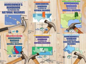
In 2007 Dennis Hwang and Darren K. Okimoto of the University of Hawai'i Sea Grant co-authored a community specific Homeowner's Handbook to Prepare for Natural Hazards. The handbook targets the average homeowner and essentially does as much homework for the homeowner as possible in order for a homeowner to prepare for natural disasters. Since 2007, the Hawai'i Homeowners Handbook to Prepare for Natural Hazards has gone through 8 print runs with over 65,000 copies. The handbook has been adapted by 7 other Sea Grant programs.
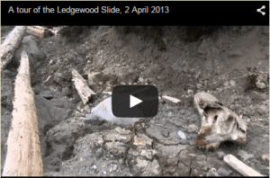
After the March 2014 Oso landslide, Washington Sea Grant communications staff volunteered at the site to provide communications support during disaster response. After the 2013 Whidbey Island landslide, a Washington Sea Grant-installed camera monitored continuing land movement.
Washington Sea Grant is synthesizing information on the resilience and vulnerability of communities to coastal hazards such as ocean acidification and leading the design of a participatory, community-based rapid appraisal in several Washington and Oregon communities facing such hazards. This appraisal will assess culturally significant ecosystem variables, such as important food species and communities’ sense of place, and identify anticipated and cumulative threats posed to them.
Washington Sea Grant is leading an effort to improve estimates of vertical land movement in Washington State, that will be used to improve sea level rise and coastal flooding assessments.

The Port Asset Matrix helps communities appraise the current value of their navigational and port infrastructure, allowing them to project the potential costs of maintaining or replacing these resources in the face of changing water levels and storm conditions caused by climate variation.
This checklist of climate-related decision points can help coastal communities smoothly integrate climate change data into their ongoing planning processes.
Wisconsin Sea Grant, in conjunction with the NOAA Great Lakes Coastal Storms Program, conducted a survey to learn the planning and implementation needs of Great Lakes coastal planners and managers to mitigate and adapt to coastal storm hazards.
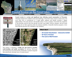
This project integrates animation, aerial photography, pictures, charts, and text to help the public better understand: (1) the natural process of coastal erosion; (2) how local land development decisions impact coastal erosion; and (3) the case for scientifically-based coastal development setbacks
This Wisconsin Sea Grant fact sheet offers some adaptation strategies for adapting to the impacts of climate change on shipping and boating infrastructure.
With funding from the EPA, Sea Grant partners with the City of Seattle among others to offer an incentive and certification credit system developed for single family homes. The goal of this voluntary program is to develop shoreline sustainably, using green vs. grey infrastructure whenever possible
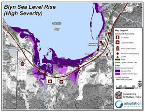
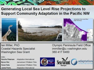
Washington Sea Grant partnered with the Jamestown S'Klallam Tribe and Adaptation International to develop a set of local sea level rise projections, and sea level scenario maps for the Jamestown S'Klallam community. The assessments are being used to identify priority adaptation actions, tribal areas or resources that are particularly vulnerable to sea level rise, and have also been integrated into community long-term planning. Additionally, Washington Sea Grant is partnering with North Olympic Peninsula Resource Conservation District and Adaptation International on a multi-sector climate change vulnerability assessment and adaptation plan, including sea level rise and coastal flooding projections for coastal communities in Clallam and Jefferson Counties.
Washington Sea Grant led the development of the Olympic National Marine Sanctuary (OCNMS) Climate Change Assessment, which examined the vulnerability of sanctuary resources to climate change. The report, intended for OCNMS staff, the OCNMS advisory committee, and the Intergovernmental Policy Council, is being used as a springboard for climate change adaptation activities in the sanctuary, and adjacent (mostly tribal) communities.
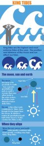
King Tides, or extreme high tides, offer the chance to view what the future might look like with higher sea levels. The King Tides Project directs citizens to capture images of King Tide events and upload them onto the website. The Washington King Tides project is part of an international collaboration.
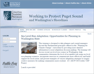
Washington Sea Grant, in collaboration with the Climate Impacts Group and the Department of Ecology offered a course through the Padilla Bay NERR’s Coastal Training Program on sea level rise adaptation. Building on the 2008 basic climate change course, this sea level rise course offered up to date scientific projections on sea level rise rates in the Padilla Bay NERR, in addition to methods to effectively communicate climate change, various planning opportunities in Washington, and examples of what others around the US have done. This course is the second in a series of climate adaptation courses.
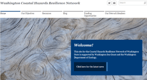
Washington Sea Grant, in collaboration with the Department of Ecology and with funding from NOAA, has developed a Coastal Hazards Resilience Network. The primary function of the network is to increase coordination and collaboration among state, federal and academic experts responsible for managing coastal hazards along the Washington Coast. The network is then applied at the local level to increase the resilience and capacity of local communities to plan for a respond to natural hazard events.
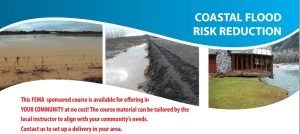
Washington Sea Grant staff members are certified to teach the FEMA-certified Coastal Flood Risk Reduction Course. This performance level course is designed to provide an introduction to flood-risk reduction opportunities within coastal communities.
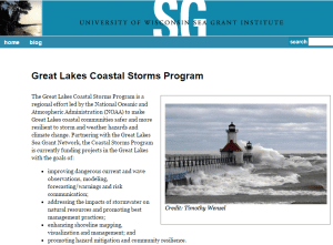
Wisconsin Sea Grant hosts the Great Lakes Coastal Storms Program website which provides resources, program updates and information related to the four primary goals of the program.
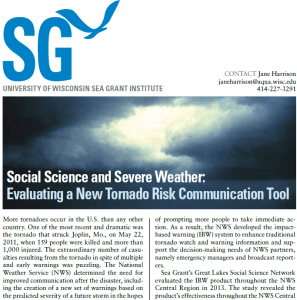
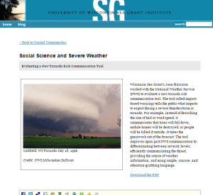
Wisconsin Sea Grant worked with the National Weather Service to evaluate a new tornado risk communication tool.
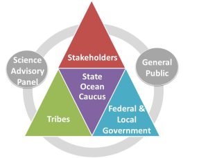
As a member of the State Ocean Caucus, Washington Sea Grant is a member of the State planning team charged by the State legislature to develop a marine spatial plan off Washington’s outer coast. The plan will provide better baseline information, ecosystem indicators, analyses to support coastal management decision-making, recommendations for siting new uses, implementation framework across agencies and sectors, integration of other existing policies and management and an adaptive management strategy. Washington Sea Grant plays a central role in this process by leading outreach, coordinating scientific review of data and projects, developing indicators of human well-being and economic health of the coast.
Wisconsin Sea Grant helped with design and development recommendations for the Lake Level Viewer.
Through the Vulnerability, Consequences, and Adaptation Planning Scenarios (VCAPS) process, North Carolina Sea Grant provides a variety of research and capacity-building initiatives to assist communities in assessing risks and providing support for developing approaches to manage that risk as appropriate.
Officials at the state and local level, as well as property owners, seek North Carolina Sea Grant for technical expertise and to work with federal partners to find solutions for new and existing building adaptations that result in increased community resilience.
North Carolina Sea Grant extension partners with the N.C. Department of Insurance and the Institute for Businesses and Home Safety Fortified training program to increase building and design standards, including workshops to train builders, as well as training for building code inspectors and other professionals.

Virginia Sea Grant helps fellows connect their research with end-users giving them the opportunity to experience the importance of considering stakeholder engagement from start to finish.
The lead coordinating organization is Wetlands Watch, working with architects at Hampton University, builders from the Hampton Roads Green Building Council, Urban Land Institute, and a suite of engineers. They are focused on Chesterfield Heights neighborhood in Norfolk, and will be creating specific designs for a more resilient Chesterfield Heights.
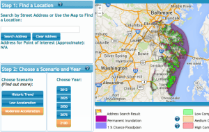
This was developed through a mid-Atlantic Sea Level Rise project we secured from Coastal Services Center (CSC). It was applied in Annapolis, and they explored its application in Hampton Roads, but it was too early in the evolution of the issues in Hampton Roads to use here. That is, this tool shows climate impacts at the individual lot level and the Hampton Roads citizenry and local elected officials were not ready to see, hear, realize that then (~2011). We are ready now and because we took an incremental approach with our community, we have been able to leap frog some of the challenges that other states faced and Fall 2014 we held a workshop with the real estate community.
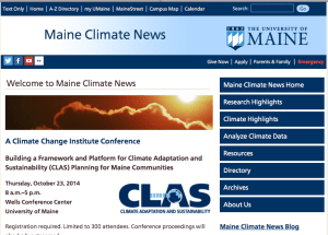
Recognizing the need for a centralized, neutral source of climate information specific to Maine, University of Maine Cooperative Extension and Maine Sea Grant created Maine Climate News in partnership with George Jacobson, Maine State Climatologist, in 2009. The site is intended to be a portal to climate change science and research at the University of Maine and beyond, as well as a resource for news and climate-related activities throughout the state. The site is updated quarterly.
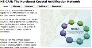
Maine Sea Grant is a member of the steering committee for the Northeast Coastal Acidification Network planning a series of 10 Ocean Acidification Webinars, a synthesis of the State of the Science, culminating in a State of the Science workshop followed by Stakeholders workshops to develop an Ocean Acidification plan for the region (Long Island Sound to Nova Scotia).
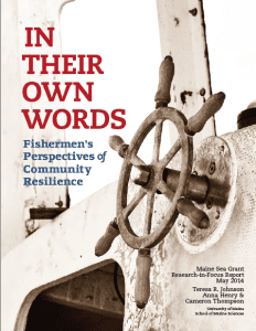
This project developed a participatory, place-based approach for assessing the vulnerability and resilience of Maine fishing communities, documenting threats and resources available to respond to those threats. To understand the forces driving vulnerability, Johnson and graduate students Cameron Thompson and Anna Henry worked with community stakeholders to identify opportunities and strategies for improving resilience of fishing communities. They produced a summary report, entitled, “In Their Own Words: Fishermen’s Perspectives of Community Resilience.”
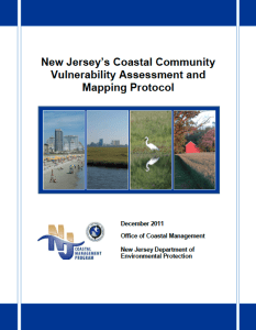
This document is intended as a guide for entities interested in assessing their vulnerability to coastal hazards. Coastal vulnerability is a complex topic that requires an understanding of some basic terms, concepts, and historical context to be effectively assessed.
A survey instrument that helps a community characterize its resilience through the connectivity of the community's various planning documents.
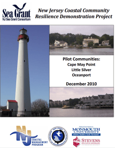
Coastal communities across the nation are faced with the challenge of how to adapt to coastal inundation associated with climate change and sea level rise. As part of the National Sea Grant Coastal Communities Climate Adaptation Initiative (CCCAI), the New Jersey Sea Grant Consortium (NJSGC) and its partners, New Jersey Department of Environmental Protection Office of Coastal Management (NJOCM), Monmouth University Urban Coast Institute (UCI) and Stevens Institute of Technology, conducted community-based, climate adaptation demonstration projects in Cape May Point, Little Silver and Oceanport, New Jersey.
Sea Level Affecting Marshes Model maps (SLAMM), will be available on the web in October for all 21 coastal communities. This is being adopted for “planning purposes” by the State Coastal Resources Management Council.
A model document for incorporating coastal hazards and climate change into state mandated Local Comprehensive Planning, together with maps that assess vulnerability, and recommendations based on lessons learned from other places for the community to adapt to rising seas.
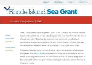
To address challenges from a changing shoreline, the Rhode Island Shoreline Change Special Area Management Plan (Beach SAMP) is focused on improving our understanding of how fast erosion is occurring and what areas and infrastructure are at risk of flooding during storms or from future sea level rise.
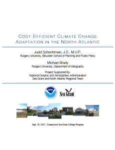
This report from a year-long study from Sea Grant and the NOAA North Atlantic Regional Team (NART) identifies some best practices that communities can use locally for adapting to climate change. “Cost-Efficient Climate Change Adaptation in the North Atlantic” is a compilation of best practices shared by 34 towns and cities (ME to VA) willing to share the steps that they have taken towards successful adaptation. The report also contains an interactive map.
Using South Kingstown Land Trust as a pilot, tools have been identified for use by local conservation organizations in Rhode Island and beyond to assess vulnerability and identify strategies to begin to implement adaptation actions through conservation, management, and investment.
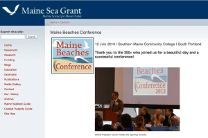
The Maine Beaches Conference provides continuing opportunities for communication and exchange of the most current information among beach stakeholders with diverse interests, and presents the findings from the state’s beach monitoring programs.
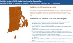
The coastal property guide is a publication and web-based tool for property owners, navigating them through 10 key questions related to issues from coastal erosion and sea level rise, to buffers and septic systems.
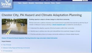
The Chester Climate Adaptation Team, including Pennsylvania Sea Grant, has the capacity to assist with community engagement to assess climate vulnerabilities, consider solutions, and to plan steps for a more resilient community.
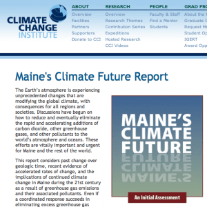
This report considers past change over geologic time, recent evidence of accelerated rates of change, and the implications of continued climate change in Maine during the 21st century as a result of greenhouse gas emissions and their associated pollutants. Maine Sea Grant’s Communication Coordinator, Catherine Schmitt worked with a multidisciplinary team to compile and edit the 2009 Report and several follow-up features on specific topics, and she is currently working on an update to the original report.
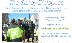
This workshop series featured municipal officials who survived Superstorm Sandy and Maine municipal officials and residents from Wells, Saco and Old Orchard Beach who traveled to New Jersey to see the aftermath of the storm first hand. During “The Sandy Dialogues” workshops in Wells and Saco presenters shared personal experiences about the storm, its aftermath and recovery.
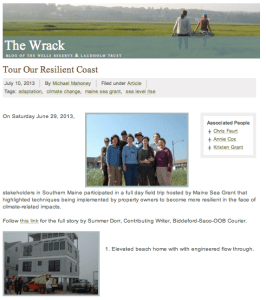
Maine Sea Grant has organized a number of tours, during which Southern Maine coastal property owners, local officials, and community members visit coastal properties in Saco, Wells, and Ogunquit where action has been or could be taken to make them more resilient to flooding, erosion, and extreme storm events.
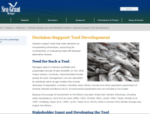
Decision-support tools to help make decisions on managing a key fishery by incorporating information, accounting for uncertainties, or evaluating trade-offs between alternative choices.
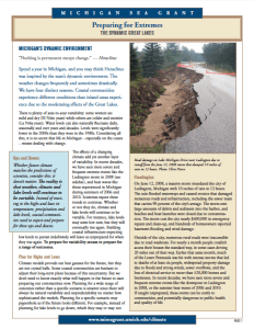
Four fact sheets addressing distinction between weather and climate, preparing for extreme conditions, variable lake levels, and climate variability
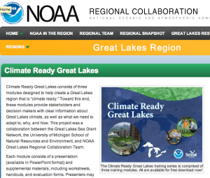
Climate Ready Great Lakes consists of three modules designed to help create a Great Lakes region that is “climate ready”.
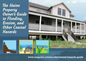
This online Guide was created by Maine Sea Grant to help coastal property owners and municipal officials identify features and different types of hazards on the Maine coast, and evaluate potential responses and actions. This guide is an outcome of the project, Coastal Community Resilience: Developing and Testing a Model of State-based Outreach.
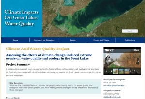
The Climate and Water Quality diagram is used for public outreach to show interaction of climate, water quality, land use and invasive species.