Education
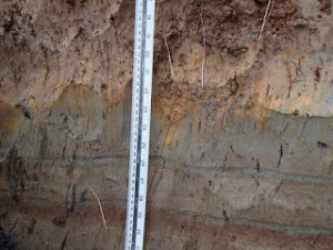
Dunes and Dune Grass Lesson Plan
Students study the essential parts of the Cape American Beach Grass Ammophila breviligulata and discover the basic necessities for plant survival.

Scroll down to view posts
Students study the essential parts of the Cape American Beach Grass Ammophila breviligulata and discover the basic necessities for plant survival.
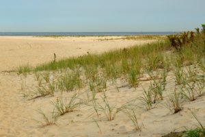
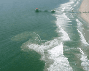
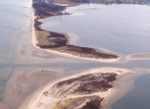
The Dune It Right manual explains dune ecology. This tool is for anyone undertaking a dune restoration or rehabilitation project. It explains what species uses what parts of the beach, how to avoid damaging habitat and how to avoid creating a monoculture.
As part of the National Sea Grant Coastal Communities Climate Adaptation Initiative (CCCAI), NJSGC is developing and implementing an education and outreach campaign designed to promote long term planning that will educate waterfront property owners and associated businesses about the need to gain an understanding of climate change and consider the potential impacts associated with it when planning for the future.
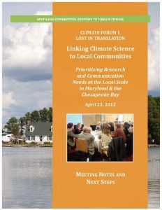
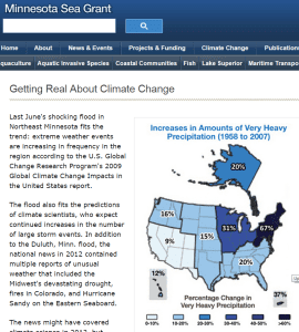
Scientists in Maryland have published numerous studies on the impacts of climate change on the Mid-Atlantic region, but communicating the results of that research has proved difficult. Many residents in the state’s coastal communities lack a good understanding of the risks that climate change and sea level rise in particular pose to their way of life. In 2012, Maryland Sea Grant held a statewide climate change forum to inform efforts to share and discuss the findings of climate science with these communities.
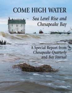
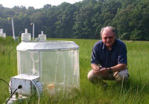
Along much of the Mid-Atlantic coast, sea levels are rising faster than the global average. This trend has already been linked to intensifying storm surges, shoreline erosion, and the loss of wetlands in the Chesapeake Bay region. To educate residents of Maryland about the impacts of sea level rise and climate change in the Chesapeake region, Maryland Sea Grant formed a unique partnership with the regional news magazine, Bay Journal. This partnership resulted in a special issue of Maryland Sea Grant’s magazine, Chesapeake Quarterly, that was published in October 2014 and titled “Come High Water: Sea Level Rise and Chesapeake Bay.”
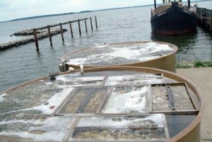
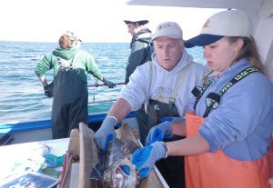
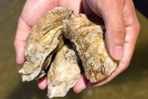
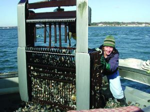
Many leaders in Maryland have highlighted the importance of developing oyster aquaculture in the state: this industry supports local working waterfronts and also helps the state’s struggling seafood industry. Maryland Sea Grant Extension helped to bring about changes in state policy to make it easier for residents to obtain leases for aquaculture operations in Chesapeake Bay, creating new opportunities for entrepreneurs. To help them pursue those opportunities, Maryland Sea Grant Extension and its partners have developed a number of programs that help shellfish growers to obtain start-up funding for these ventures and to build and operate them successfully.
Rhode Island’s Ocean Special Area Management Plan, developed in part by Rhode Island Sea Grant, helped identify areas suitable for offshore windfarm construction and expedited the permitting process, putting Rhode Island on a path to developing the first offshore wind farm in the U.S.
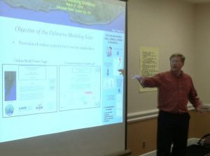
Maryland Sea Grant supported a research project to develop a Nutrient Loading Model for the Delmarva Peninsula. Other collaborators and funders on the effort included Sea Grant programs in Delaware and Virginia.
Maryland’s coastal wetlands provide diverse ecosystem services for the Chesapeake Bay region, reduce flooding risks, and help to improve local water quality. These natural communities, however, also face threats from rising sea levels and invasive species. Of particular concern is the non-native reed Phragmites australis, which has displaced native marsh grasses in many Mid-Atlantic wetlands in recent decades. To inform the management of this invasive reed, Maryland Sea Grant funded research to better understand how climate change might affect the growth of Phragmites populations around Chesapeake Bay.
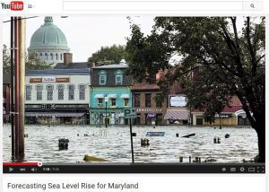
Maryland Sea Grant produced a nine-minute online video documentary that describes scientific research about the causes of rising seas in the Chesapeake Bay region.
The introduction of aquatic invasive species to Chesapeake Bay, transported through the ballast water of cargo ships or by live animal and plant trades, can bring ecologically harmful consequences. To safeguard local ecosystems, Maryland Sea Grant supports programs that seek to prevent the establishment of new invasive species in the region.
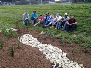
Maryland and other states in the Chesapeake Bay watershed are currently engaged in a multi-billion dollar effort to improve water quality by meeting Total Maximum Daily Load (TMDL) targets for nutrients and sediments. To accomplish this, municipalities around the region need help from trained and dedicated volunteers who can implement watershed restoration practices. Such practices include stormwater management tools like rain gardens and barrels.
With support and training from Texas Sea Grant, Maryland Sea Grant Extension employs the weTable tool to facilitate decision-making processes in a range of communities.
In May 2014, Maryland Sea Grant, in partnership with the NOAA National Centers for Coastal Ocean Science (NCCOS), held a workshop to explore the use of remote sensing for detecting harmful algal blooms in the Chesapeake Bay region.
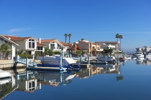
This website contains information, data, and tools that individuals, communities, and governments at all levels can use to develop, inform, and enhance their sustainable working waterfront initiatives.
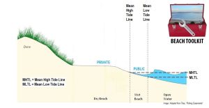
Part of the Florida Water Access site, the Beaches Toolkit contains an outline of common law tools for addressing public beach access, as well as resources for public and private managers of beachfront property.
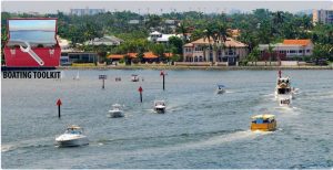
Part of the Florida Water Access site, the Boating Toolkit contains legal information about rights of navigation, anchoring and mooring, boating laws and regulations, derelict vessels and conservation.
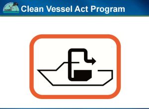
This site discusses both the Florida Clean Marina Program, the Florida Clean Vessel Act Program and the available funding opportunities.
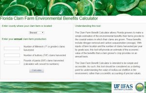
The Clam Farm Benefit Calculator allows Florida clam growers to make a simple estimation of the environmental benefits their farms provide annually to coastal waters.
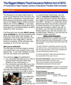
This site provides answers for homeowners regarding flood insurance costs, purchasing flood insurance and ways to reduce insurance premiums.
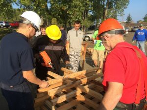
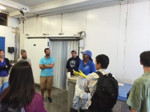
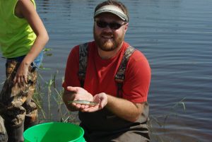
Working with Pennsylvania Fish and Boat Commission and local anglers, Pennsylvania Sea Grant involves high school students from Central Career and Technical School in building structures to improve fish habitat in Lake Erie.

Oregon Sea Grant's Coastal Natural Hazards Specialist stresses preparedness, not panic or indifference, in the wake of increased attention to the Cascadia Subduction Zone and the likelihood of an earthquake in Oregon.
Harmful algal blooms in Lake Erie impact drinking water, wildlife, and tourism. Ohio Sea Grant and Ohio State's Stone Lab are working with a wide range of partners to protect the health and well-being of lakeshore residents and the ecosystem.
North Carolina Sea Grant works with citizen scientists to collect data on an invasive aquatic plant and with state partners to raise awareness on the threat that the plant presents in North Carolina.

The Dune It Right manual is designed to be an evolving resource for anyone planning dune restorations. It uses NJSGC research and researchers to bring the most relevant data and methods for restoring dunes along New Jersey's intensely developed shore.
A symposium at Hofstra University was held to share a NOAA Coastal Storm Awareness Program-funded project that explored the cultural and language barriers that may have hindered evacuation efforts in Long Beach, NY.
Sea Grant-NMFS Fellows gather in Miami for an annual symposium.

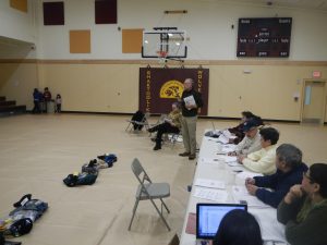
The city of Chelsea, Massachusetts' Planning Board has new climate change adaptation guidance thanks to a group of students from Worcester Polytechnic Institute and MIT Sea Grant.
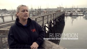
An Oregon Sea Grant Extension Agent is featured in an Oregon State University project.
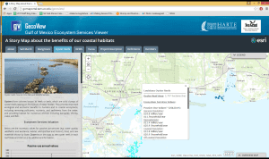
The Gulf of Mexico Ecosystem Services Viewer shows, in an interactive format, the values people place on salt marshes, mangroves and oyster reefs in the Gulf of Mexico. Based on research results, this tool fills an informational gap in the Gulf.
NOAA’s Coastal Storms Program is collaborating with Sea Grant and others to improve safety for Great Lakes beach-goers.
" I get to work with some of the most passionate, smart, and genuine people I have ever met, helping them to manage and protect some of the most beautiful and unique places in the country. "
Great Lakes Sea Grant programs and a network of Great Lakes-region partners are promoting a new water safety campaign, Be Current Smart.
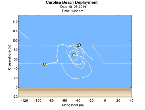
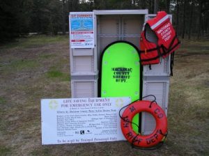
Rip currents account for 80 percent of beach rescues. North Carolina Sea Grant's data-logging drifters identify patterns in this beach hazard.
” Everyone needs to be informed about weather and consequently wave dynamics on the lake and in the nearshore zone.”
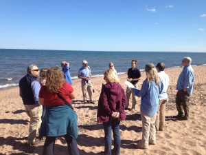
Federal, state, and local partners come together to discuss the forecasting and communication of rip currents and other coastal hazards on the eve of beach season.
New York Sea Grant is asking people along Lake Ontario and North Sandy Pond to share stories and photos of storm events to help local communities better assess risk, build storm resiliency, and reduce future storm damage and recovery expenses.
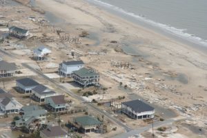
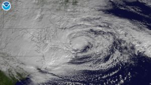
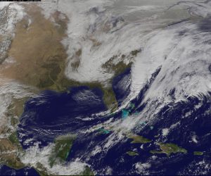
As Hurricane Season begins, Sea Grant continues to prepare coastal communities for hurricanes and coastal storms. Learning from past events, Sea Grant aims to strengthen the resilience of infrastructure and empower coastal residents.
Making yourself hurricane-proof is a deliberate act. Residents of storm-prone areas need a plan and to be able to execute it. The Homeowners Handbook helps individuals make their families and homes more resilient.
Ohio Sea Grant and the Ohio Department of Natural Resources will expand the Ohio Clean Marinas and Clean Boater programs statewide in 2015.
” Since I didn't have a marine science or oceanography background, the Sea Grant Knauss fellowship opened the door for me at NOAA and within policy. It can also do this for others.”
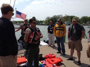
Sea Grant works with coastal communities to ensure that boaters on the water for fun and for work are knowledgeable and out of harm's way.
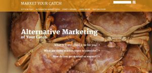
A collaborative, Sea Grant social science effort has led to the development of a website that guides fishermen through the process of entering alternative markets, bringing them closer to the consumer.
It's Safe Boating Week. Recreational anglers are also boaters. On Lake Michigan, those recreational anglers need to be aware of safety concerns surrounding commercial fishing trap nets. That's where Wisconsin Sea Grant steps in, sharing maps showing net locations.
With the summer season fast approaching, New York Sea Grant offers safe boating tips and gives a sneak peak at its related campaign, which, now in its ninth season, has reached over a half-a-million people.
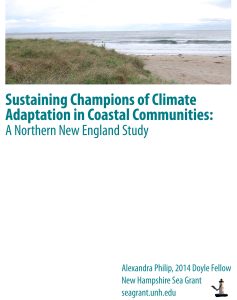
Leaders who are helping their coastal communities adapt to sea level rise, increases in heavy precipitation and flooding need additional technical, human and financial assistance to do so, according to a report by a 2014 New Hampshire Sea Grant Doyle Fellow.
“If you are at all thinking about marine science policy, definitely apply for the fellowship!”
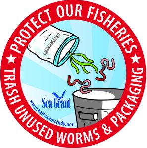
To reduce the spread of aquatic invasive species, a project led by Maryland Sea Grant educated fishers to properly dispose of the seaweed packaging used to ship blood worms.
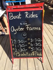
Tourists are increasingly interested in experiences that allow them to support and connect with the people and places that they visit. Maine Sea Grant is facilitating such experiences by assisting with the creation of oyster farm tours, combining the tourism and fisheries industries that already exist in Maine.
Once an important waterway to reach the French Quarter, then forgotten, Bayou St. John has been restored and become a destination for many New Orleanians.
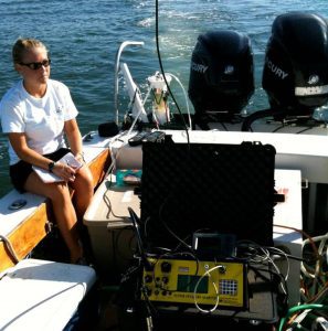
A large percentage of South Carolina’s economy is driven by the popularity of beaches as tourist destinations. Hypoxic (low-oxygen) conditions have been documented in the nearshore coastal waters of Long Bay, South Carolina, during summer months over the past several years. To maintain a healthy environment for recreation it is necessary to assess the impacts of land use on groundwater discharge to the area. Researchers measured radon activities of shallow beachface groundwater and nearshore bottom waters to estimate mixing rates and submarine groundwater discharge in Long Bay. They successfully developed a mixing model based on these measurements, which helped determine that natural phenomena such as limited mixing and submarine groundwater discharge (both previously overlooked) can significantly influence nearshore water quality and lead to hypoxic conditions. This model can be applied to other types of marine environments to help determine the causes of hypoxia, and as such could be a valuable tool in maintaining coastal water quality, especially in highly developed (urban) areas.
Community leaders, decision-makers, and staff need detailed knowledge of the resources their community possesses in order to make informed planning decisions that enhance the community while protecting the quality of the environment. Developed in partnership with Clemson University’s Baruch Institute of Coastal Ecology and Forest Science, the S.C. NEMO Program, Carolina Clear, and the North Inlet-Winyah Bay National Estuarine Research Reserve, the Community Resource Inventory provides an atlas of natural and cultural resources available in South Carolina coastal communities.
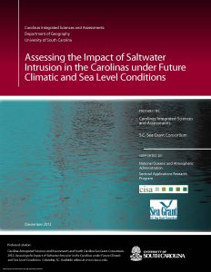
Reduced river flows during drought threaten fresh water supplies in coastal areas because the lower flows allow the salt water wedge to penetrate further inland from estuaries than is normal. During droughts over the past decade, some coastal drinking water systems and industries monitored threats to fresh drinking water and industrial water intakes due to this salinity intrusion; some have even had to periodically take intakes offline due to high salinities that can damage drinking water treatment systems and industrial equipment. To help decision-makers understand how the frequency of salt water intrusion events may change under future precipitation and sea level scenarios, the S.C. Sea Grant Consortium, the Carolinas Integrated Sciences and Assessments center at the University of South Carolina, and the USGS S.C. Water Science Center adapted an existing decision support system for salinity intrusion in the coastal Yadkin-Pee Dee river basin by adding climate model-based precipitation scenarios and increments of sea level rise to the Model 2 (PRISM2) decision support tool. This modification is significant in that it allows water managers to explore how often salt-water intrusion events may occur in the Yadkin-Pee Dee River basin under conditions influenced by ongoing and future climatic change.
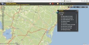
The Governors’ South Atlantic Alliance (GSAA) Data Portal is an online toolkit and resource center that consolidates available state, regional, and federal datasets into one location for Florida, Georgia, South Carolina, and North Carolina. This allows users of the Portal to learn about the region’s data resources, explore a robust repository, and visualize these data via the Portal tools. Developed by the Southeast Coastal Ocean Observing Regional Association (SECOORA) with NOAA support through the S.C. Sea Grant Consortium, the GSAA Portal provides a foundation for long-term collaborative planning in the South Atlantic region for a wide range of coastal uses.
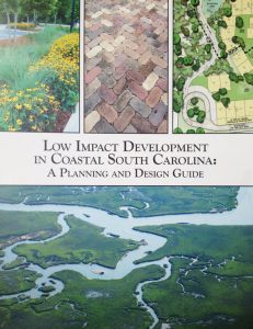
Many coastal decision-makers lack the expertise, guidance, and resources to implement low impact development (LID) techniques for mitigating stormwater impacts. The S.C. Sea Grant Consortium assisted with the development of an LID manual specific to coastal South Carolina that provides guidance on overcoming barriers to implementing best management practices. The project team organized stakeholder workshops, research roundtables, and provided technical assistance with the development of the guide.
The Southeast and Caribbean Climate Community of Practice (CoP) brings together individuals from local, state, and federal governments, academia, non-profit organizations and the private sector in North Carolina, South Carolina, Georgia, Florida, and the Caribbean to apply climate science and assess how coastal communities and ecosystems can adapt to the impacts of climate variability and change. The CoP provides a forum for sharing lessons learned and best practices related to climate communication and adaptation. The CoP also provides education and networking opportunities to its members and their stakeholders to increase knowledge and awareness of climate science and to coordinate and perform outreach, extension, and communication related to climate change and its impacts in the Southeast and Caribbean region.
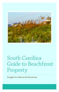
Many residents of South Carolina and beyond aspire to live at the beachfront. To better prepare people seeking beachfront homes (as well as those already enjoying life at the beachfront) regarding specific hazards and regulations, the S.C. Department of Health and Environmental Control Office of Ocean and Coastal Resource Management, with significant contributions from the S.C. Sea Grant Consortium, has produced the South Carolina Guide to Beachfront Property. Included is information on typical hazards homeowners are likely to face (hurricanes, erosion, flooding, wind, and earthquakes), insurance information, and important state regulations regarding construction and renovation practices.
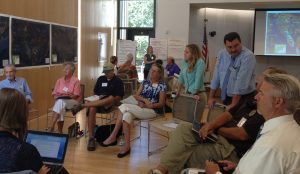
The S.C. Sea Grant Consortium, in partnership with the Beaufort County Planning Department, Carolinas Integrated Sciences and Assessments program, Social and Environmental Research Institute, and North Carolina Sea Grant, provided a participatory opportunity for Beaufort County to begin preparing for flooding associated with sea level rise. The project team utilized several available tools to engage local stakeholders in the process. A focus group participated in the Vulnerability and Consequences Adaptation Planning Scenarios process to identify local consequences of sea level rise and explore potential adaptation strategies. Sea level rise visualizations developed with data from NOAA’s Digital Coast Sea Level Rise Viewer tool helped stakeholders understand the risks of future coastal flooding due to rising seas. Public workshops were held to get broader input on adaptation strategies. A final report has been compiled for consideration by Beaufort County Council. This project has initiated a process of community learning that will increase the capacity of Beaufort County to adapt to sea level rise.
With the vast majority of land-use decisions made at the local level, community officials are instrumental in influencing and directing development and conservation efforts. The S.C. Coastal Communities Initiative is a collaborative land-use planning and water quality small grants program for local decision-makers. The purpose of the Initiative is to assist coastal communities with the development and implementation of land management policies and practices to reduce polluted stormwater runoff, protect local natural resources, and encourage sustainable development. Coastal communities participating in the Initiative are eligible to receive grants ranging from $2500 to $5000 to address a variety of issues related to open space preservation, natural resource-based planning, water quality management, alternative transportation, sustainable community planning and design, and zoning ordinances and regulations.
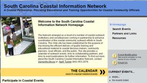
Forging and maintaining outreach and education partnerships is vital to building and sustaining effective and pertinent outreach programming. The South Carolina Coastal Information Network (SCCIN) enhances coordination of coastal community outreach efforts in South Carolina by avoiding duplication of efforts and minimizing the number of meetings/workshops that community leaders and staff are asked to attend, leveraging scarce resources, and maximizing program benefits and expected outcomes. Through the SCCIN, members strive to provide quality training and educational materials to coastal decision-makers and the public in an effective and efficient manner.
Lake Champlain Sea Grant is partnering with organizations across Vermont to help towns plan and prepare for climate change and flood resiliency.
By incorporating social science into the equation, Great Lakes Sea Grant programs are helping to meet societal needs.
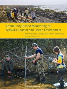
A handbook to help Alaska communities, scientists, and agencies implement best practices for new and continuing community-based monitoring programs.
The University of Hawai‘i Sea Grant College Program took the initiative over 10 years ago to form a partnership with the Hawai‘inuiÄkea School of Hawaiian Knowledge and Awaiaulu to help make Hawaiian language newspapers articles from the 1800’s and early 1900’s accessible to the general public.
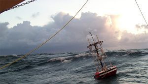
Washington Sea Grant’s hazard specialists expose the dangers on a coast where even the Coast Guard is vulnerable.
A new Coastal Storm Awareness Program study finds that many residents of coastal Connecticut need to be better prepared for the significant safety and economic threats posed by severe coastal storms.
A new study announced by California Sea Grant reports on the first seven years of monitoring within four marine protected areas between San Francisco and Morro Bay.
Tsunamis have been a reality for coastal communities for as long as humans have lived near the shore. NOAA Sea Grant has been working with coastal communities for many years to help residents understand tsunami risks, reduce their vulnerability and respond quickly.
Sea Grant funded-researchers from the Virginia Institute of Marine Science may have found a positive side to an oyster parasite and its impact on vibrios bacteria.
New York Sea Grant received funding from NOAA's Coastal Storms Program through a Sea Grant competition to study historic storm events along the eastern shore of Lake Ontario. The project will create a climatological event database to better assist risk projection to help communities increase their storm event resiliency.
While many Sea Grant agents work with commercial fisheries, Sheffield’s role is unique. There are few commercial fisheries in the north of Alaska – the primary fishery there is a subsistence one. A study done on Saint Lawrence Island, in the southern Bering Strait, found that 80 percent of the population ate only subsistence food an average of 5 days per week.
Dr. John Jacob takes a holistic approach to educating citizens and local officials, noting that the watershed is affected by a wide range of activities from landscaping and other things people do around their homes to large urban planning and habitat protection activities.

David Hart is Assistant Director for Extension with the University of Wisconsin Sea Grant Institute and a Senior Scientist with the UW Aquatic Sciences Center. His research and outreach spans geographic information science, urban planning, and coastal management.

Experts at New York Sea Grant discuss issues, and potential solutions between communication and the decision process as they relate to extreme weather events.

Georgia Sea Grant has partnered with the Carl Vinson Institute of Government at the University of Georgia to create the new Georgia Sea Grant Legal Program. This program offers students at University of Georgia School of Law the opportunity to work with legal and policy experts to address challenging environmental questions facing policymakers in coastal Georgia communities.
Is there room on the water for everybody? If coastal communities are to remain sustainable, residents, visitors, policy makers, and regulators need new methods and information sources to harmonize the growing demand for access to their beaches and waterways. Researchers and extension specialists at Florida Sea Grant are making that challenge a priority.
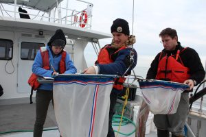
Zooplankton are a key food source in the marine food web and can contain the larvae of commercially important species, such as oysters, crabs and various finfish. Delaware Sea Grant funded researchers are using a new technology to analyze and quantify zooplankton in the Delaware Bay.
Connecticut Sea Grant assists aquaculture industry, bringing policy makers and stakeholders together, netting new benefits for ocean crop loss.
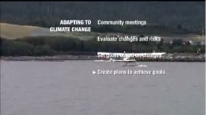
This video describes steps some communities are taking to maintain their lifestyles in the face of climate change.
Rockfish were overfished in the 1970s and 1990s, and Rockfish Conservation Areas were put in place. Little is known about the species distribution within the conservation areas now. A team put together by California Sea Grant and The Nature Conservancy hopes to better understand the distribution so that resource managers may allow for more fishing opportunities.
This manual is for Alaska extension professionals, community organizers, local planning officials, and teachers, whose task is to help individuals, families, businesses, communities, and local governments think through the meaning of climate change on the local scale.
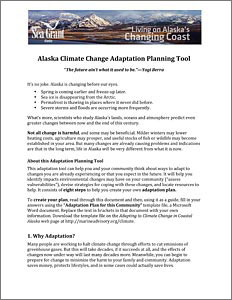
This adaptation tool will help Alaska community residents identify impacts from environmental changes, devise strategies for coping with the changes, and locate resources to help.
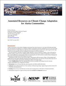
These climate change adaptation resources are useful to community residents and professionals who are planning strategies for adaptation.
Alaska Sea Grant’s climate adaptation website has links to Alaska-specific climate change fact sheets, videos, Powerpoint presentations, other publications, and websites of other organizations and resources.
Washington Sea Grant funded scientists help track down a virus involved in what may be the largest marine wildlife epidemic ever seen. Meanwhile, Washington Sea Grant monitors see a surge of healthy young sea stars.
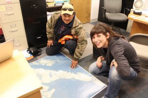
Alaska Natives are witnessing climate changing the ecology around their communities. Three southwestern communities are partnering with Alaska Sea Grant researchers to share their traditional hunting knowledge in an effort to conserve their marine environment.
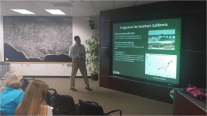
The Santa Barbara Area Coastal Ecosystem Vulnerability Assessment for Local Communities (SBA CEVALC) is aimed at assisting the Cities of Santa Barbara, Carpinteria, and Goleta and the County of Santa Barbara in planning for adaptation to climate change. Three of the state's leading ecological and climatological research programs including: the UCSB Coastal Long-Term Ecological Research Project, the Scripps Institution of Oceanography and USGS, are accomplishing the project in close collaboration with the three cities and County. Community input is integral to the project with staff from relevant city/county departments participating through workshops and review.
Alaska Sea Grant Marine Advisory agent Terry Johnson and others assisted the village of Shaktoolik with planning and implementing measures to “defend in place” against coastal storms.
Microbeads have drawn a lot of public and political attention since 2012, when researchers from New York and Wisconsin discovered millions of the tiny particles in several Great Lakes. But this new study suggests microfibers may be an even larger concern in at least a few areas.
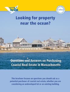
Are you considering buying property near the water? A new brochure from Woods Hole Sea Grant, Questions and Answers on Purchasing Coastal Real Estate in Massachusetts is now available. This brochure focuses on questions you should ask (and where to find the answers) as a potential purchaser of coastal real estate. This resource provides information about permitting, erosion and erosion control structures, flood insurance, and much more.
The permitting processes for oyster restoration projects can be challenging to navigate, as a maze of state and federal programs may apply. A new legal research report, released by the National Sea Grant Law Center and the Mississippi-Alabama Sea Grant Legal Program, hopes to make these processes a little more easy to navigate by providing an overview of the permitting programs in 21 states.
“I use the skills I gained from my experience as a Knauss fellow on a daily basis in my career. The writing and policy analysis skills that I developed as a fellow have been critical. In addition, while at the Commission, we worked with 16 commissioners with diverse backgrounds to develop a consensus report. The experience of working with a group like that to evaluate stakeholder input, discuss policy ideas and develop recommendations has been valuable.” – Angela Gustavson
I use so many of the skills and experiences I gained as a Knauss fellow at my current position. I remained in the Army Corps after my fellowship and I continue to work with many of my former coworkers. I learn new things every day about my agency.
“I truly believe the opportunity that I was given as a Knauss Fellow has led to the fact that I have been in D.C. for 10 years. My job in Sam Farr’s office gave me the launching pad for my career that ultimately led to the White House,” – Jessican Maher
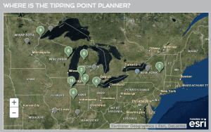
Tipping Points and Indicators, a research and extension program for Great Lakes coastal communities, helps local decision makers identify impacts of land-based activities that threaten the sustainability of ecosystems in their watershed. This program includes a web-based decision support syst​em (tippingpointplanner.org) and facilitated forum to explore policy and management interventions necessary to keep coastal ecosystems from reaching critical tipping points and moving to unstable conditions.
This National Sea Grant Resilience Toolkit allows people to learn about tools from across the entire Sea Grant network giving users the opportunity to adapt tools for their own local needs. Each entry includes a description of the tools, a link for more information, and a point of contact.
The purpose of this assessment tool is to provide community leaders, administrators, planners, engineers, public work directors, and natural resource managers with a simple method in the form of a checklist divided into nine different categories to review their community's particular vulnerabilities to climate trends and to identify priority areas to focus on through planning and projects. The goal of this tool is to help communities in the Great Lakes region identify and address vulnerabilities through education and planning to help reduce the impacts and costs of climate change-related damage through adaptation policies and procedures.
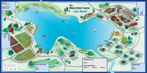
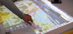
The Watershed Game is an interactive tool that helps community leaders understand the connections between land use, clean water and their community. Participants learn how a variety of land uses impact water and natural resources and learn how their choices can prevent adverse impacts.

Lake sturgeon have been on the planet for 150 million years. Despite that long residency, scientists are still learning about these fish, the largest found in North America. An enduring question is what contributes to their survival skills. Answer: Sound. As one factor anyway.
Vertical land movement, caused by sediment settling, groundwater extraction, and tectonic forces, can boost or reduce the local effects of global sea level rise. Conventional wisdom says that the offshore collision of two continental plates is pushing up Washington’s and Oregon’s coastlines. This assumption may make coastal communities complacent about climate change and sea level rise. Using tidal-gauge and GPS readings, Washington Sea Grant’s Ian Miller and colleagues have found that vertical land movement actually varies dramatically along Washington’s shores. While the Olympic Coast’s northwest corner is rising, the land is actually subsiding as little as 30 miles down the coast – and along densely populated Puget Sound. Communities need local data to prepare for rising seas.