Climate
Climate and Water Quality Diagram
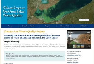
The Climate and Water Quality diagram is used for public outreach to show interaction of climate, water quality, land use and invasive species.

Scroll down to view posts
The Climate and Water Quality diagram is used for public outreach to show interaction of climate, water quality, land use and invasive species.
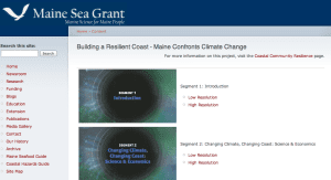
This video was created for Maine citizens to hear and see what their neighbors, town officials, and local scientists have to say about sea-level rise, coastal flooding, and erosion; what it means to them; and what individuals can do about it in the five-part documentary, Building a Resilient Coast: Maine Confronts Climate Change, produced in partnership with Oregon Sea Grant.
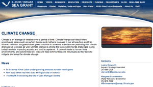
Illinois-Indiana Sea Grant has a climatologist on staff who conducts workshops and interacts with local resource managers along southern Lake Michigan to help the region become more resilient. We have produced or participated in the creation of number tools to help communities.
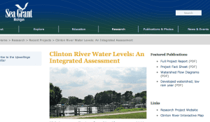
An integrated assessment research project and deliverables to support Clinton River watershed decision-makers in water resources management.
Lake Michigan provides a reliable supply of drinking water for a large population in the greater Chicago area of northeastern Illinois and northwestern Indiana, but is being tapped to its legal limit. Water supply planning can increase preparedness for droughts and climate change, reduce regional conflicts, and promote conservation. Illinois-Indiana Sea Grant has tools to help communities with sustainable water pricing, outdoor conservation, sample ordinances, etc.
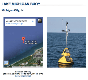
Illinois-Indiana Sea Grant maintains a buoy off the coast of Lake Michigan in Indiana and will soon be installing a second buoy in waters on the Illinois side. The buoys are equipped with sensitive scientific instruments that help scientists, managers, and local community members understand how the lake works, how things look today, and how things will look in the future.
During extreme high tide events, known as king tides, Californians get an idea of what future sea level may look like in their coastal communities. USC Sea Grant has had the privilege to be part of several collaborative projects that are tracking, recording and analyzing these high tides events in order to predict future sea level rise.

This web-based GIS decision system is designed to improve comprehensive land use planning so that economic, ecological, social, and cultural resources are integrated with future development in a sustainable way.
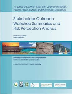
Details stakeholder outreach activities for the Climate Change and the Visitor Industry project, summarizing the state of knowledge of current and potential impacts of climate change on Hawai‘i’s tourism industry and coastal communities; identifying opportunities for adaptation and sustainability of the tourism industry; informing Hawai‘i’s decision-makers in the public and private sector of the potential impacts of climate change, and; providing an opportunity for the visitor industry stakeholders to provide feedback on the findings and assist in the identification of priority sectors for adaptation.
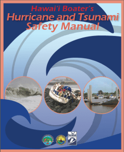
Provides a summary of the actions boaters and other members of Hawai‘i’s maritime community can take before, during, and after a hurricane or tsunami, to prepare for and mitigate the effects of these hazards.
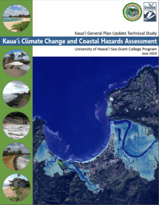
As a technical report for the Kaua‘i County General Plan update, the KC3HA looks to improve the community’s resilience and preparedness to coastal hazards and changing climate through the better understanding and utilization of coastal hazard information and planning tools. The report compiles and summarizes available science-based coastal and climate hazard information to assist in information the General Plan update.

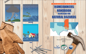
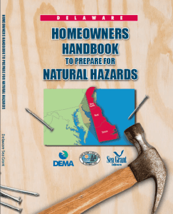
Helps homeowners prepare for a natural hazard so that risks to family and property may be reduced. The handbook focuses on tsunami, hurricane, earthquake, and flood hazards.
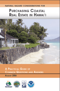
This guide focuses on basic question to consider as an investor in coastal real estate, emphasizing the importance of having an understanding of the potential risks and consequences of living on the ocean’s edge.
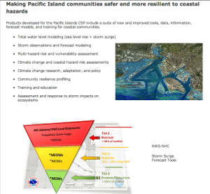
This nationwide effort implemented in the Pacific Islands Region funded several projects that foster community resiliency through outreach, education, and product development.
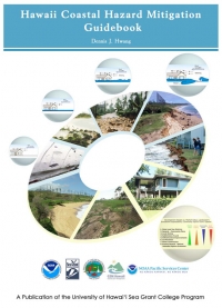
The purpose of the 242 page guidebook is as a resource to reduce the risk to coastal development by planning for natural hazards such as erosion, flooding, tsunami, and hurricanes. The guidebook uses scientific and technically-based standards for hazard mitigation and provides recommendations for implementation (e.g., guidance, industry standards, policy and the use of existing regulations) that minimize burden to the regulated community.
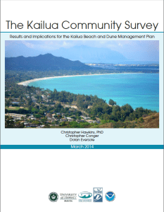
A report on resident’s attitudes, perceptions, preferences, and values towards a variety of socio-environmental topics. The study is part of a regional beach management and climate change adaptation planning efforts, and informs implementation and future modification of the 2010 Kailua Beach and Dune Management Plan.
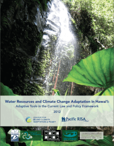
Describes Hawai‘i’s water resources, identifies troubling trends (i.e., declining rainfall, reduced stream flow, increasing temperature, and rising sea level), and provides12 potential adaptive tools for adaptive management of those water resources.
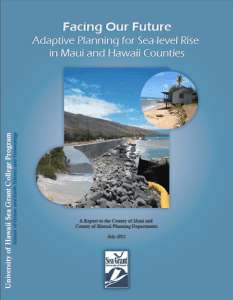
Five recommendations are presented to provide a foundation for improving shoreline planning for coastal hazards, including seal level rise, at the local level.
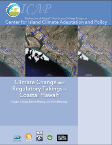
In light of projected sea level rise and adaptation responses (i.e., accommodate, protect, and retreat), this paper examines the interactions among climate change, the regulation of shoreline development in Hawai‘i, and Constitutional law regarding unpermitted takings of private property for public benefit.
The Texas Coastal Planning Program helps community leaders through workshops that help them determine their readiness and plan for future needs with respect to coastal hazards, green infrastructure, water quality impairment and other issues related to sustainable development.
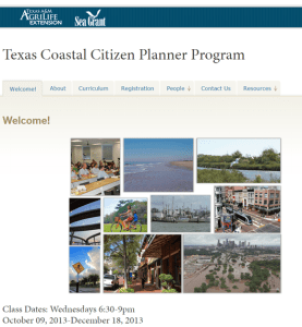
The Texas Coastal Citizen Planner program provides elected and appointed officials the knowledge and skills necessary to make informed land use decisions that lead to long-term hazard management, natural resource conservation, safer neighborhoods, and improved quality of life.
Mississippi-Alabama Sea Grant has provided technical assistance in the form of holding workshops, hosting webinars, participation in community floodplain management groups, and development of outreach materials specifically designed for community's who participate in the National Flood Insurance Program's Community Rating System.
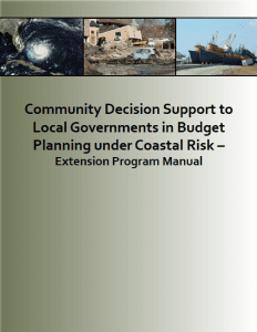
This decision support tool can be used to identify the optimal policy alternative to allocate financial reserves necessary for local governments along the coast to minimize the financial burden of cleanup, recovery, and reconstruction costs from future tropical storm events.
The handbook covers basic information on emergency preparedness, evacuation planning, flood/wind insurance, and steps to take to protect your property.
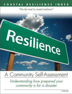
The Coastal Community Resilience Index is a self-assessment tool that brings together elected officials, public works directors, emergency managers, and other leaders at the community-government level to take an in-depth look at their community’s level of resilience. They discuss 57 indicators organized around six categories to identify vulnerabilities, capitalize on strengths and assess future impacts of disasters.
Oregon Sea Grant offers facilitation services that guide dialogue in the process of making important decisions about coastal planning and we serve as a bridge between university resources and local end users.
Over the past 200 years, Rhode Island has lost over 50 percent of its salt marshes due to coastal development, resulting in a loss of approximately 4,000 acres statewide. Rhode Island Sea Grant and partners are working to develop the Sea Level Affecting Marshes Model (SLAMM). The model will be used to help identify the most vulnerable areas to target for protection and restoration.
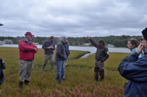
New Hampshire Sea Grant helped identify community adaptation strategies for the partner members of the Coastal Adaptation Workgroup (CAW), including a matrix of over 40 actions that communities can take to improve their climate adaptation capacity and implementation.
These are participatory mapping tools that a number of Sea Grant programs are using for community-based work addressing both climate and stormwater issues.
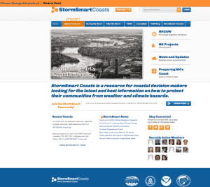
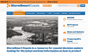
The StormSmart Coast website serves as a “resource for coastal decision makers looking for the latest and best information on how to protect their communities from weather and climate hazards” (http://stormsmartcoasts.org/)
Since 2011, New Hampshire Sea Grant has helped to develop and contribute to “The Crow's Nest” blog about climate adaptation in New Hampshire, which is available on StormSmart Coasts, as a tool to communicate timely information about events and resources available to communities related to adaptation
“The Crow’s Nest” is an electronic newsletter about climate adaptation in New Hampshire.
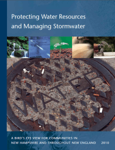
This is an outreach tool designed to guide communities through a range of strategies from landscape to plot level for water quality protection.
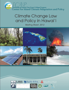
This briefing sheet provides a timeline of and descriptions for legislative actions related to climate change mitigation and adaptation in Hawai‘i.
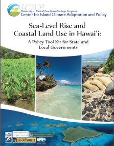
The purpose of this Tool Kit is to identify and explain key land use policy tools for state and local government agencies and officials to facilitate leadership and action in support of sea-level rise adaptation in Hawai‘i.
MIT Sea Grant is working with fishing community representatives to develop the Fishermen Rescue Project (FRP); a community based program geared towards developing a best management guide for responding to fishing emergencies and managing media relations.
MIT Sea Grant (MITSG) recently hosted the Climate Change Symposium on Sustaining Coastal Cities, a three-day conference that brought together regional partners and stakeholders from academia, non-profit organizations, federal, state, and local governments, to discuss major issues and facilitate regional collaborations.
MIT Sea Grant Climate Change Web Site features resources that promote climate literacy, along with tools useful for assessing vulnerability and improving planning processes
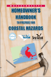
The Massachusetts Homeowner's Handbook to Prepare for Coastal Hazards provides tools and resources useful in helping communities mitigate coastal impacts.
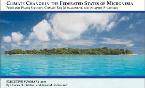
This study is an outgrowth of concern over the vulnerability of the Federated States of Micronesia (FSM) to sea-level rise and drought associated with climate change. The purpose is to identify climate risk and options in the FSM.
How is global warming influencing the climate in Hawai‘i? The purpose of this briefing sheet is to describe what is known in answer to this question as published in peer-reviewed scientific journals and in government reports and websites.
This report provides a basic summary of the observed and projected changes to Hawai‘i’s ecosystems and their resulting impacts for the state’s residents. The report focuses on five (5) systems: (1) marine ecosystems – (a) open ocean and (b) coral reefs and other nearshore habitats; (2) coasts and the built environment; (3) terrestrial ecosystems; (4) freshwater resources; and, (5) human health.
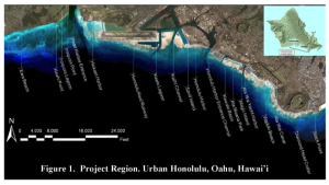
In an effort to comprehensively and accurately assess the risks of future coastal hazards and the vulnerability of the community, the project included the following key steps: (1) mapping of projected sea level rise (SLR) scenarios to provide a baseline assessment of the potential impacts of inundation due to SLR, (2) modeling and mapping potential coastal hazards under elevated sea level conditions, specifically (a) tsunami inundation and (b) hurricane storm surge inundation, and (3) a socio-economic exposure analysis of the above inundation zones, as well as a 500-year flood hazard zone.
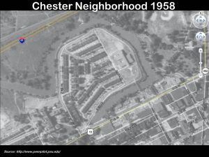
With funding from the 2012 National Sea Grant Climate Adaptation Competition, Chester was selected as a model coastal community for integrating climate change adaptation planning into economic revitalization efforts. Here are recommendations from the Chester Climate Task Force adopted as an addendum to the Vision 2020 comprehensive plan for the City by Chester City Council on June 25, 2014. (PDF, 80 pages).
This toolkit was developed to assist communities in identifying planning, mitigation and adaptation opportunities that will help reduce vulnerabilities to natural hazards and climate impacts.
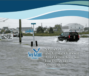
More than 80 major storms have threatened Delaware’s coast over the past three decades, putting lives and property at risk. The resource guides residents on practical measures that can keep them safe and minimize damage to homes and property.
To help reduce Delaware communities’ vulnerability to coastal hazards, the Delaware Sea Grant College Program, University of Delaware’s Coastal Community Enhancement Initiative, and Delaware’s Department of Natural Resources and Environmental Control have cooperated with the Delaware Emergency Management Agency to increase awareness of coastal hazards and provide communities information and resources that will improve societal, economic and personal resiliency to coastal hazards.
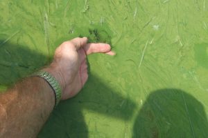
Connecticut Sea Grant partnered with the University of Connecticut Law School and the National Sea Grant Law Center to hold two conferences on resilience

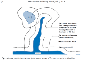
Connecticut Sea Grant partnered with CLEAR and the Connecticut Department of Energy and Environmental Protection (DEEP) to conduct a Geographic Information System (GIS) time series analysis using maps of the Connecticut shoreline from time periods between 1880 and 2006
NOAA Sea Grant announced today grants totaling $15.9 million to support over 300 projects around the nation that help build resilient coastal communities and economies. Through university, state and other partnerships, Sea Grant Programs will supplement the federal funding with an additional $7.9 million in non-federal matching funds, bringing the total investment to more than $23.8 million.
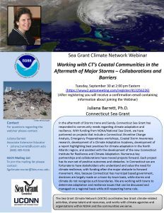
Please join us for the first Sea Grant Climate Network Webinar. Connecticut Sea Grant's Juliana Barrett will be discussing CT's work with coastal communities following major storms.

The National Weather Service selected the Sea Grant Great Lakes Social Science Network to assess the Impact-based Warning System because of Sea Grant strong reputation for engaging local, sometimes hard to reach, communities.
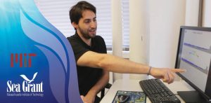
MIT Sea Grant Assistant Director for Research Stefano Brizzolara and visiting PhD student Riccardo Angelini Rota are working on a new numerical model to simulate the complex physics that happen in the near-shore region to waves. Due to climate change, they explain, the level of the ocean will rise significantly in the next fifty to one hundred years. Their goal is to simulate the risks of flooding in different areas of the Northeast region in advance in order to be prepared and react with mitigation or adaptation strategies. The model is based on a Smoothed Particles Hydrodynamic (SPH) solver, which helps them reproduce the hydrodynamic phenomena in coastal areas, specifically in the surf region. Brizzolara and Rota plan to reproduce problems like over-topping in a sea wall or in a sea structure and the run up of waves. They explain that the reason this new model is so unique is because many of the models that currently exist are able to arrive quite close to the coast but not in the particular region where the non-linear phenomena they want to record occur. With this new numerical method, the researchers seek to extend the predictions of the current numerical models to the areas more affected by inundations and flooding.
Louisiana Sea Grant passes along lessons learned from Hurricane Katrina to those impacted by the aftermath of Hurricane Sandy.
Six new geocaches are now located in Superior. Geocaching is a high-tech version of orienteering that relies on a hand-held Global Position System unit instead of a compass. These geocaches are part of a Wisconsin Sea Grant-funded project designed to highlight the history of the state’s shipping industry.
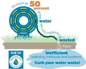
Water conservation has moved center stage in the Chicago suburbs. Summer shortages are a major concern here, and communities are looking to tackle the problem at its source: inefficient outdoor water use.
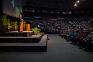
Former Vice President Al Gore gave a rousing seminar to discuss climate change science and sustainability at University of Hawaii Sea Grant.
Michael Slattery first got involved with Sea Grant during his Ph.D. program when Sea Grant funded a portion of his research into rip currents. He is now a coastal processes extension specialist and works on rip current outreach and awareness.

Dr. Chris Houser is an Associate Professor in Geography and Geology and Geophysics at Texas A&M University. His general area of expertise is geomorphology, the study of the natural features of the earth and the physical processes that shape them.
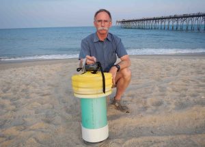
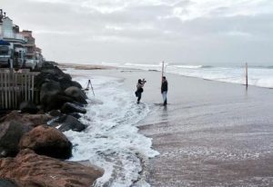
As the summer beach season opens, Spencer Rogers of North Carolina Sea Grant has new tools to better understand dangerous rip currents.
Bob Guza is a California Sea Grant funded researcher. He is an Integrative Oceanography Division Professor, Oceanography at Scripps Institution of Oceanography University of California, San Diego.
Elizabeth LaPorte works with colleagues at U-M and MSU to ensure the alignment of Sea Grant’s activities with the mission of the National Sea Grant College Program and the needs of Michigan’s stakeholders. She identifies opportunities to leverage research through public outreach and education.
Backed by University of Wisconsin Sea Grant, a grad student will use a concept called storm transposition to show Wisconsin communities why they may want to invest in climate change resilience.