Official websites use .gov
A .gov website belongs to an official government organization in the United States.

Secure .gov websites use HTTPS
A lock ( ) or https:// means you’ve safely connected to the .gov website. Share sensitive information only on official, secure websites.

Post Archives
Tag: Sea Level Rise

  Scroll down to view posts

(top left) A hand holding a pen traces a map for determining flood risk; (top right) an aerial view of waterfront property flooding; (bottom left) a walkway to docked fishing boats on the left and right; (bottom right) a person speaking and pointing to a flipchart while other participants listen.
Climate

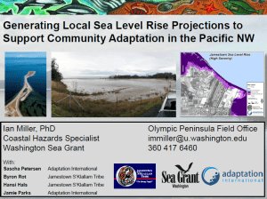
NOAA Sea Grant Advances Resilient Coastal Communities with $4 Million in Support

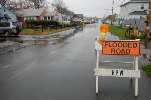
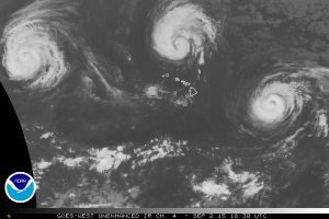
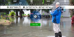
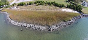
Sea Grant programs across the U.S. are scaling up capacity to support additional hands-on, collaborative engagement to advance the sustainability of coastal and Great Lakes communities. Sea Grant awarded $4 million in fiscal year 2023 funds to its grant-based programs nationwide to continue or expand ongoing work or address new opportunities for coastal climate adaptation and resilience for the communities that Sea Grant serves.

Read More >
Climate

Water Cities: Can We Climate-Proof the Coast?

South Carolina Sea Grant Consortium is based in Charleston, S.C., one of the U.S. cities most threatened by a rising global sea level. More intense rainstorms combined with unusually high tides have communities rethinking traditional flood control structures. 

Read More >
Alabama

A Collaborative Effort Against Sea Level Rise

In the spirit of the collaborative nature of NOAA's Sentinal Site Program, Sea Grant provides coordinators to foster relationships among the various partners studying sea level rise and addressing community resilience. 

Read More >
Climate

Needs Assessment of New Jersey Business Owners

As part of the National Sea Grant Coastal Communities Climate Adaptation Initiative (CCCAI), NJSGC is developing and implementing an education and outreach campaign designed to promote long term planning that will educate waterfront property owners and associated businesses about the need to gain an understanding of climate change and consider the potential impacts associated with it when planning for the future. 

Read More >
Climate

Maryland Climate Science Communication Forum

Scientists in Maryland have published numerous studies on the impacts of climate change on the Mid-Atlantic region, but communicating the results of that research has proved difficult. Many residents in the state’s coastal communities lack a good understanding of the risks that climate change and sea level rise in particular pose to their way of life. In 2012, Maryland Sea Grant held a statewide climate change forum to inform efforts to share and discuss the findings of climate science with these communities.

Read More >
Climate

Special Magazine Report Examines Sea Level Rise and Coastal Hazards

Along much of the Mid-Atlantic coast, sea levels are rising faster than the global average. This trend has already been linked to intensifying storm surges, shoreline erosion, and the loss of wetlands in the Chesapeake Bay region. To educate residents of Maryland about the impacts of sea level rise and climate change in the Chesapeake region, Maryland Sea Grant formed a unique partnership with the regional news magazine, Bay Journal. This partnership resulted in a special issue of Maryland Sea Grant’s magazine, Chesapeake Quarterly, that was published in October 2014 and titled “Come High Water: Sea Level Rise and Chesapeake Bay.”

Read More >

Coastal Climate Adaptation Initiative

Woods Hole Sea Grant funded a climate adaptation project designed to provide regional and local predictions of future coastal storm activity and sea-level rise to user groups within the region and to promote wise utilization and conservation of resources. 

Read More >
Climate

Assessing vulnerability to sea level rise in Beaufort County, S.C., using facilitated dialogue and visualization tools

The S.C. Sea Grant Consortium, in partnership with the Beaufort County Planning Department, Carolinas Integrated Sciences and Assessments program, Social and Environmental Research Institute, and North Carolina Sea Grant, provided a participatory opportunity for Beaufort County to begin preparing for flooding associated with sea level rise. The project team utilized several available tools to engage local stakeholders in the process. A focus group participated in the Vulnerability and Consequences Adaptation Planning Scenarios process to identify local consequences of sea level rise and explore potential adaptation strategies. Sea level rise visualizations developed with data from NOAA’s Digital Coast Sea Level Rise Viewer tool helped stakeholders understand the risks of future coastal flooding due to rising seas. Public workshops were held to get broader input on adaptation strategies. A final report has been compiled for consideration by Beaufort County Council. This project has initiated a process of community learning that will increase the capacity of Beaufort County to adapt to sea level rise.

Read More >
High water
Climate

The land also rises (and falls)

Vertical land movement, caused by sediment settling, groundwater extraction, and tectonic forces, can boost or reduce the local effects of global sea level rise.  Conventional wisdom says that the offshore collision of two continental plates is pushing up Washington’s and Oregon’s coastlines. This assumption may make coastal communities complacent about climate change and sea level rise. Using tidal-gauge and GPS readings, Washington Sea Grant’s Ian Miller and colleagues have found that vertical land movement actually varies dramatically along Washington’s shores. While the Olympic Coast’s northwest corner is rising, the land is actually subsiding as little as 30 miles down the coast – and along densely populated Puget Sound. Communities need local data to prepare for rising seas.

Read More >
Vertical Land Movement Estimates
Climate and Hazard Adaptation

Vertical Land Movement Estimates

Washington Sea Grant is leading an effort to improve estimates of vertical land movement in Washington State, that will be used to improve sea level rise and coastal flooding assessments.

Read More >
Community-based Sea Level-Rise Projections
Climate

Community-based Sea Level-Rise Projections

Washington Sea Grant partnered with the Jamestown S'Klallam Tribe and Adaptation International to develop a set of local sea level rise projections, and sea level scenario maps for the Jamestown S'Klallam community. The assessments are being used to identify priority adaptation actions, tribal areas or resources that are particularly vulnerable to sea level rise, and have also been integrated into community long-term planning. Additionally, Washington Sea Grant is partnering with North Olympic Peninsula Resource Conservation District and Adaptation International on a multi-sector climate change vulnerability assessment and adaptation plan, including sea level rise and coastal flooding projections for coastal communities in Clallam and Jefferson Counties.

Read More >
Shoreline Monitoring Toolbox
Decision Support Tools

Puget Sound Shoreline Monitoring Toolbox

Washington Sea Grant, working with the Puget Sound Partnership and Puget Sound Ecosystem Monitoring Program Nearshore Work Group, has standardized approaches for monitoring and a “toolbox” of protocols and information. The toolbox emphasizes methods that are simple and affordable, and that can be used for monitoring restoration sites and evaluating status and trends. 

Read More >
Coastal Training Program
Climate

Sea Level Rise Adaptation Course

Washington Sea Grant, in collaboration with the Climate Impacts Group and the Department of Ecology offered a course through the Padilla Bay NERR’s Coastal Training Program on sea level rise adaptation. Building on the 2008 basic climate change course, this sea level rise course offered up to date scientific projections on sea level rise rates in the Padilla Bay NERR, in addition to methods to effectively communicate climate change, various planning opportunities in Washington, and examples of what others around the US have done. This course is the second in a series of climate adaptation courses.

Read More >
FutureCoast Sea Level Rise Web-Based Tool
Climate

FutureCoast Sea Level Rise Web-Based Tool

This was developed through a mid-Atlantic Sea Level Rise project we secured from Coastal Services Center (CSC). It was applied in Annapolis, and they explored its application in Hampton Roads, but it was too early in the evolution of the issues in Hampton Roads to use here. That is, this tool shows climate impacts at the individual lot level and the Hampton Roads citizenry and local elected officials were not ready to see, hear, realize that then (~2011). We are ready now and because we took an incremental approach with our community, we have been able to leap frog some of the challenges that other states faced and Fall 2014 we held a workshop with the real estate community.

Read More >
New Jersey Coastal Community Resilience Demonstration Project: Pilot Communities: Cape May Point
Extension

New Jersey Coastal Community Resilience Demonstration Project: Pilot Communities: Cape May Point, Little Silver, Oceanport


Coastal communities across the nation are faced with the challenge of how to adapt to coastal inundation associated with climate change and sea level rise. As part of the National Sea Grant Coastal Communities Climate Adaptation Initiative (CCCAI), the New Jersey Sea Grant Consortium (NJSGC) and its partners, New Jersey Department of Environmental Protection Office of Coastal Management (NJOCM), Monmouth University Urban Coast Institute (UCI) and Stevens Institute of Technology, conducted community-based, climate adaptation demonstration projects in Cape May Point, Little Silver and Oceanport, New Jersey. 

Read More >
Sea Level Affecting Marshes Model Maps
Climate

Sea Level Affecting Marshes Model Maps

Sea Level Affecting Marshes Model maps (SLAMM), will be available on the web in October for all 21 coastal communities. This is being adopted for “planning purposes” by the State Coastal Resources Management Council.

Read More >
North Kingstown Coastal Resilience Pilot
Climate and Hazard Adaptation

North Kingstown Coastal Resilience Pilot

A model document for incorporating coastal hazards and climate change into state mandated Local Comprehensive Planning, together with maps that assess vulnerability, and recommendations based on lessons learned from other places for the community to adapt to rising seas.

Read More >
Shoreline Change Special Area Management Plan
Coastal Economy

Shoreline Change Special Area Management Plan

To address challenges from a changing shoreline, the Rhode Island Shoreline Change Special Area Management Plan (Beach SAMP) is focused on improving our understanding of how fast erosion is occurring and what areas and infrastructure are at risk of flooding during storms or from future sea level rise.

Read More >
Coastal Property Guide
Coastal Economy

Coastal Property Guide

The coastal property guide is a publication and web-based tool for property owners, navigating them through 10 key questions related to issues from coastal erosion and sea level rise, to buffers and septic systems.

Read More >
Biophysical research
Climate and Hazard Adaptation

Biophysical Research

We support an array of interdisciplinary research in the biological sciences, including topics such as coastal geomorphology mapping and assessments on the cumulative effects of sea level rise and increased wave heights.

Read More >
Southern Maine Beach Profile Monitoring Program
Healthy Coastal Ecosystems

Southern Maine Beach Profile Monitoring Program

Beach profiling is a simple surveying technique used to measure changes in the contour of the monitored beach. The Southern Maine Volunteer Beach Profile Monitoring Program is a unique collaboration among local volunteers, participating municipalities, and scientists, resulting in 15 years of critical data on the status of one of Maine's most vital and valuable natural resources.

Read More >
Building a Resilient Coast video
Coastal Economy

Building a Resilient Coast video

This video was created for Maine citizens to hear and see what their neighbors, town officials, and local scientists have to say about sea-level rise, coastal flooding, and erosion; what it means to them; and what individuals can do about it in the five-part documentary, Building a Resilient Coast: Maine Confronts Climate Change, produced in partnership with Oregon Sea Grant.

Read More >
Education Coordinator
Climate

Beware the Rising Tide

During extreme high tide events, known as king tides, Californians get an idea of what future sea level may look like in their coastal communities. USC Sea Grant has had the privilege to be part of several collaborative projects that are tracking, recording and analyzing these high tides events in order to predict future sea level rise.

Read More >
Climate

Kaua‘i Climate Change and Coastal Hazards Assessment (KC3HA)

As a technical report for the Kaua‘i County General Plan update, the KC3HA looks to improve the community’s resilience and preparedness to coastal hazards and changing climate through the better understanding and utilization of coastal hazard information and planning tools. The report compiles and summarizes available science-based coastal and climate hazard information to assist in information the General Plan update.

Read More >
Climate

Climate Change and Regulatory Takings in Coastal Hawai‘i

In light of projected sea level rise and adaptation responses (i.e., accommodate, protect, and retreat), this paper examines the interactions among climate change, the regulation of shoreline development in Hawai‘i, and Constitutional law regarding unpermitted takings of private property for public benefit.

Read More >
Gulf of Mexico Climate Community of Practice
Alabama

Gulf of Mexico Climate Community of Practice

The Climate Community of Practice brings together extension, outreach and education professionals and community officials in the Gulf to learn how coastal communities can adapt to sea-level rise, precipitation changes and other climate-related issues.

Read More >
Chester City Interactive Inundation Maps
Great Lakes

Chester City Interactive Inundation Maps

The Chester Climate Adaptation Team produced this series of 11 interactive Google Maps to assess the risk to the City's population, infrastructure, and environment from varying levels of flooding.

Read More >
Rhode Island Salt Marsh
Climate

Tracking Salt Marshes: Impacts of Sea Level Rise

Over the past 200 years, Rhode Island has lost over 50 percent of its salt marshes due to coastal development, resulting in a loss of approximately 4,000 acres statewide. Rhode Island Sea Grant and partners are working to develop the Sea Level Affecting Marshes Model (SLAMM). The model will be used to help identify the most vulnerable areas to target for protection and restoration.

Read More >
The City of Chester Vision 2020 Climate Adaptation Planning Elements
Climate

The City of Chester Vision 2020 Climate Adaptation Planning Elements

With funding from the 2012 National Sea Grant Climate Adaptation Competition, Chester was selected as a model coastal community for integrating climate change adaptation planning into economic revitalization efforts. Here are recommendations from the Chester Climate Task Force adopted as an addendum to the Vision 2020 comprehensive plan for the City by Chester City Council on June 25, 2014. (PDF, 80 pages).

Read More >

Will Septic Systems Fail to Protect Sensitive Ecosystems?

George Loomis, a soil scientist and director of the New England Onsite Wastewater Training Center at the University of Rhode Island, is part of a research team supported by Sea Grant that is looking at the current designs and parameters for septic systems against various climate change scenarios.

Read More >

Forecasting Sea level Rise in Maryland

Scientists release new projections for future sea level rise for the Chesapeake Bay and for Maryland, Virginia and nearby Mid-Atlantic coastal areas. In these, regions sea levels are rising faster than the global average, the result of subsiding lands, a slowing Gulf Stream and melting land ice in Antarctica.

For more information on this study see Maryland Sea Grant

Read More >
Scroll to Top